.png)
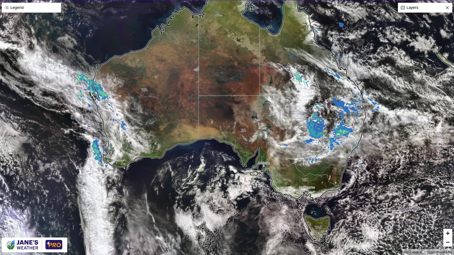
As we head into the weekend there are two big weather systems on either side of the country.
The first affects parts of Queensland and northern/coastal NSW. Mainly over inland parts on Friday, heavier near the coast on Saturday - with the potential for big falls north of Brisbane (mainly centred between Bundaberg and Mackay, but extending inland to Emerald). Stream showers affect the rest of the coast, lasting into next week as the main part of this weather system moves away on Sunday. In all of this Sydney is set for another very wet weekend.
On the other side of the country we see our next feed of tropical moisture in action - a juicy band of cloud coming in from the Indian Ocean. This one is meeting up with a front off the coast, and will feed the next front due over the weekend. This combination brings significant rain, extending well inland. Perth may see 50 to 75 mm over the next week, including the next front due late Wednesday/Thursday.
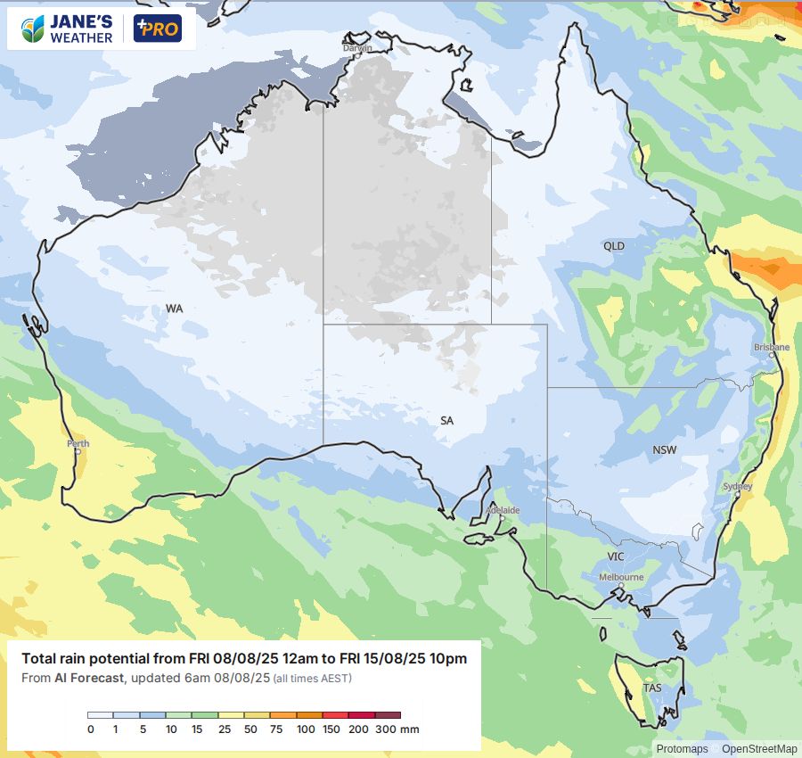
If you're in the southeast there is high pressure for the weekend, then that high (and the next one too) reduces both the instability and moisture from the western cold front, meaning there is much less wet weather when it passes through on Monday/Tuesday/Wednesday.
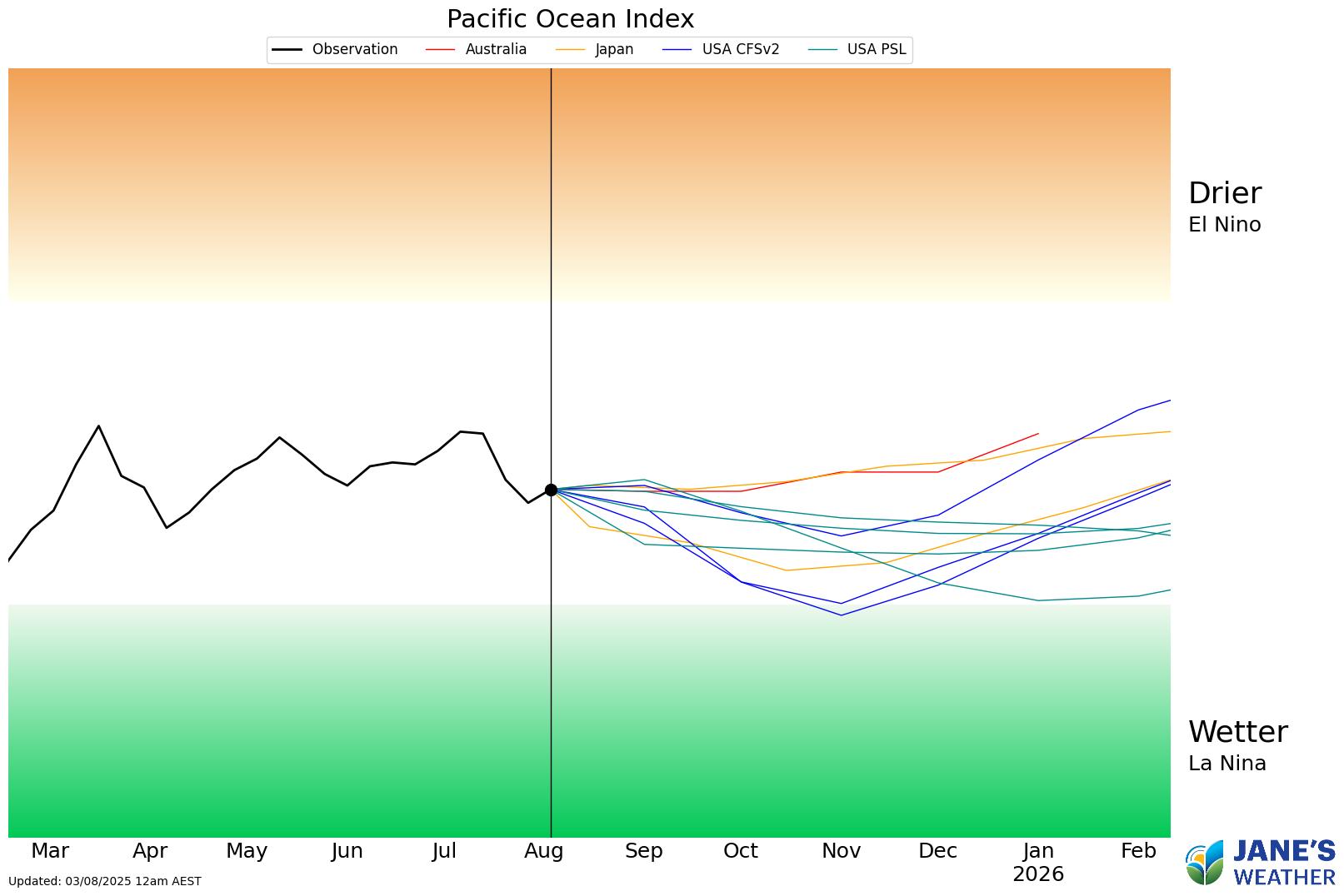
Looking further afield and international modelling for the Pacific Ocean show a few models nearing the La Nina threshold later in the year. Most suggest firmly Neutral or on the La Nina side of Neutral but this is one to watch.
The Indian Ocean crossed the threshold into a Negative Indian Ocean Dipole (IOD) a few weeks ago. If it remains there for 8 weeks it will be declared a Negative IOD year. Most modelling suggests it will, and the current QLD/NSW rain system (the cloud originated in the Indian Ocean before moving eastwards) and the southwestern weather systems are great examples of how this phase helps enhance the rainfall when it runs into low pressure.
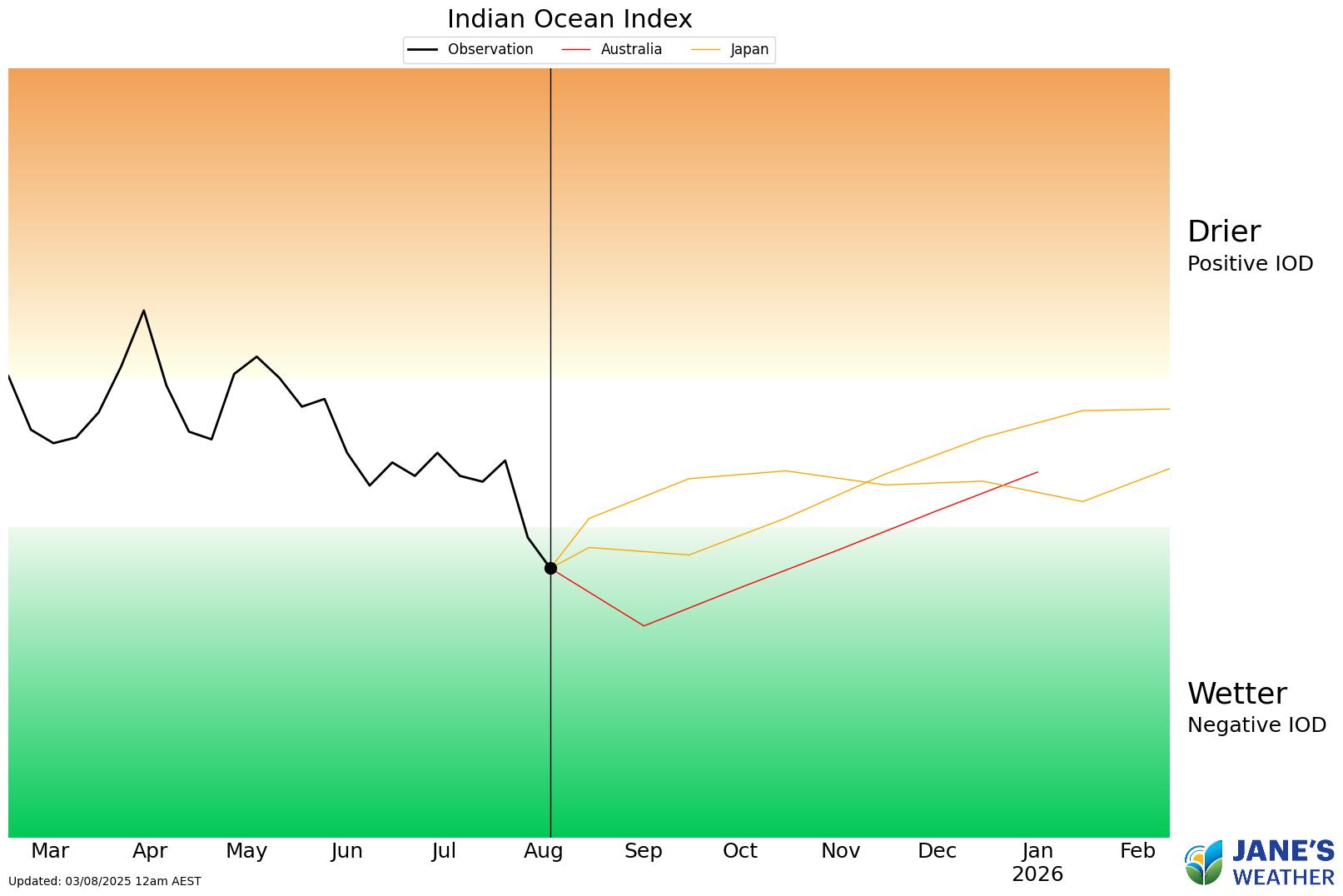
But always remember, your need to have the low pressure move to your spot in order to unlock that rainfall.
If you'd like to be guided through all of this and have 16 minutes to spare, please see my latest video:
In this series I'll take you through the drivers of our weather, highlighting any changes over time and things to watch out for (generally every Sunday). It covers weather elements like temperature and rainfall, and how they are driven by moisture from the Pacific and Indian Oceans, as well as bursts of energy from low pressure (SAM and MJO).
See and hear my commentary as I take you through the weather pattern's effects on our rain and temperatures in detail over the next week, with a brief look at week 2 and beyond as well.
Plus what is driving our weather in the weeks and months ahead, with the latest on El Nino/La Nina, the Indian Ocean Dipole (IOD), the Southern Annular Mode (SAM controls our weather systems), and the Madden Julian Oscillation (MJO connects tropical moisture to our weather systems).
I update this commentary each week, generally on Sundays. Make sure you are signed up (free or a subscription) so you don't miss an update.
Stay up to date with the forecast specifically for your area in our hour by hour outlook for the next 10 days. Download our app for iPhone and Android.
As always, you can see each of these graphics as soon as they update, as well as more information about them under our Rain Outlook and Seasonal Outlook pages within Jane's Update, along with our Snow Forecast in the snow season.

For further insights specifically for agriculture, to improve the utilisation of your resources, tailored to any Australian location, please upgrade your membership. You can take advantage of our free 30 day trial.
Upgrade to see full insights to help plan the best use for your resources:
- frost risk
- spraying conditions
- evapotranspiration to efficiently manage available water for crops
- growing degree days to monitor growth
- full ten day hour by hour outlooks, all variables, and all model data
- customised alert notifications
.png)
.png)
.png)