.png)
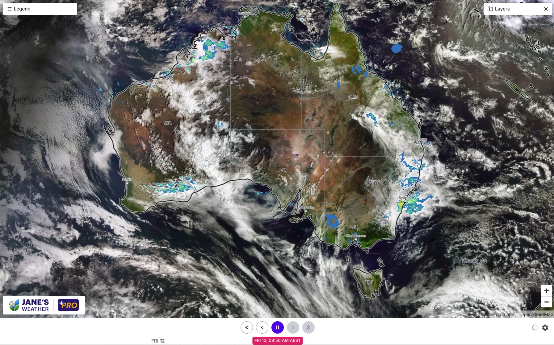
We have a brief burst of heat in the southeast, followed by showers and storms to the east of the trough which brings a cool change. This will slowly progress northeastwards across eastern Australia over the weekend.
That means the southeast is at the top of the never ending temperature roller coaster, and about to head to the bottom - before the next jump up in temperature mid next week.
That timing also means that southeast Queensland doesn't see the storms until early next week, while Sydney has them on Friday, and then again later Saturday into early Sunday.
Meanwhile, the heat doesn't abate in the west until later on Monday. That heat will arrive in the southeast mid next week.

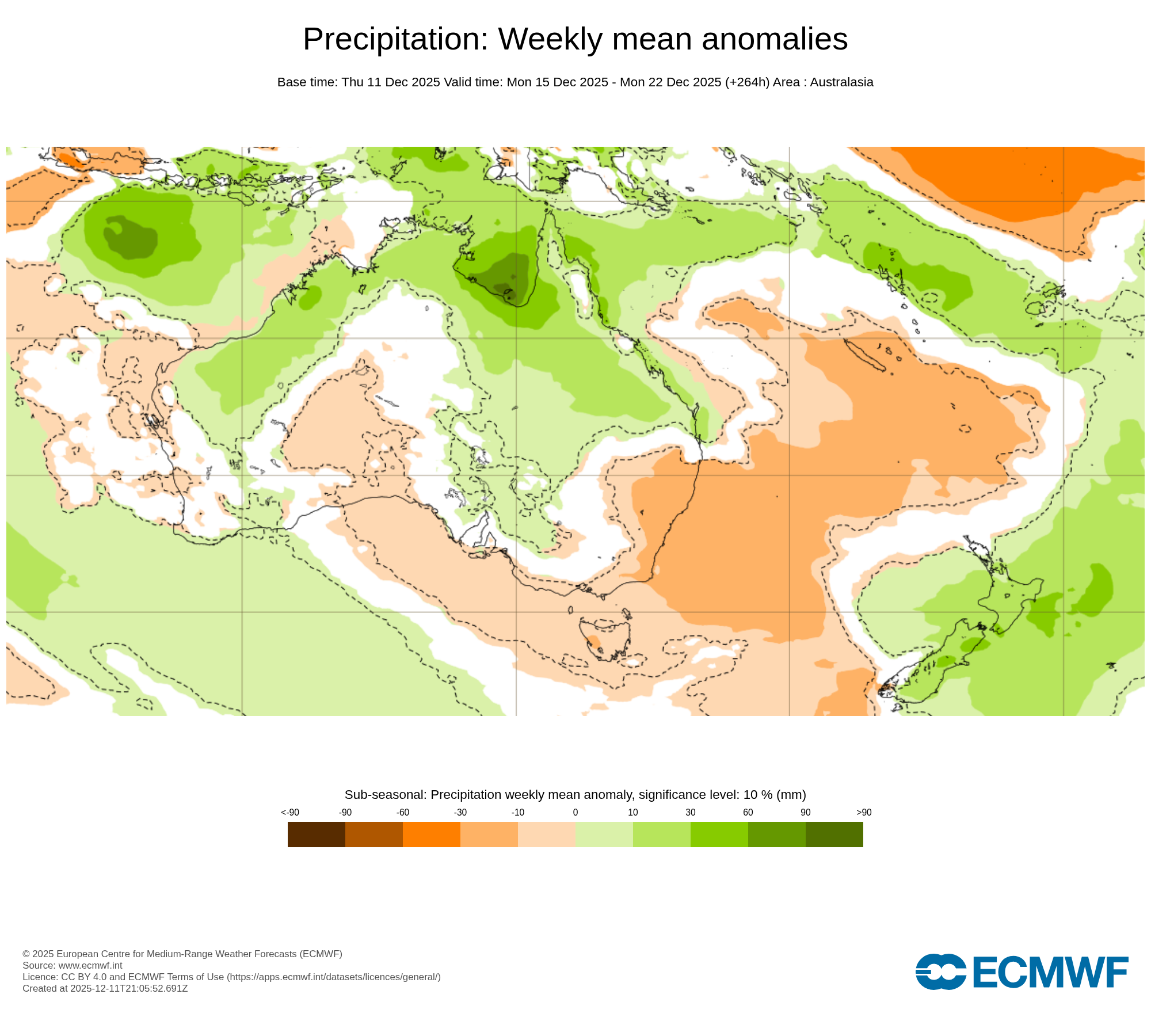
BoM and ECMWF guidance are at odds with each other as to which parts of the country are set for rain later next week. Euro likes it to come down through western NSW and VIC (one to watch if you are harvesting), and spread across Queensland.
BoM has a very different picture, keeping the rain confined to the western inland.
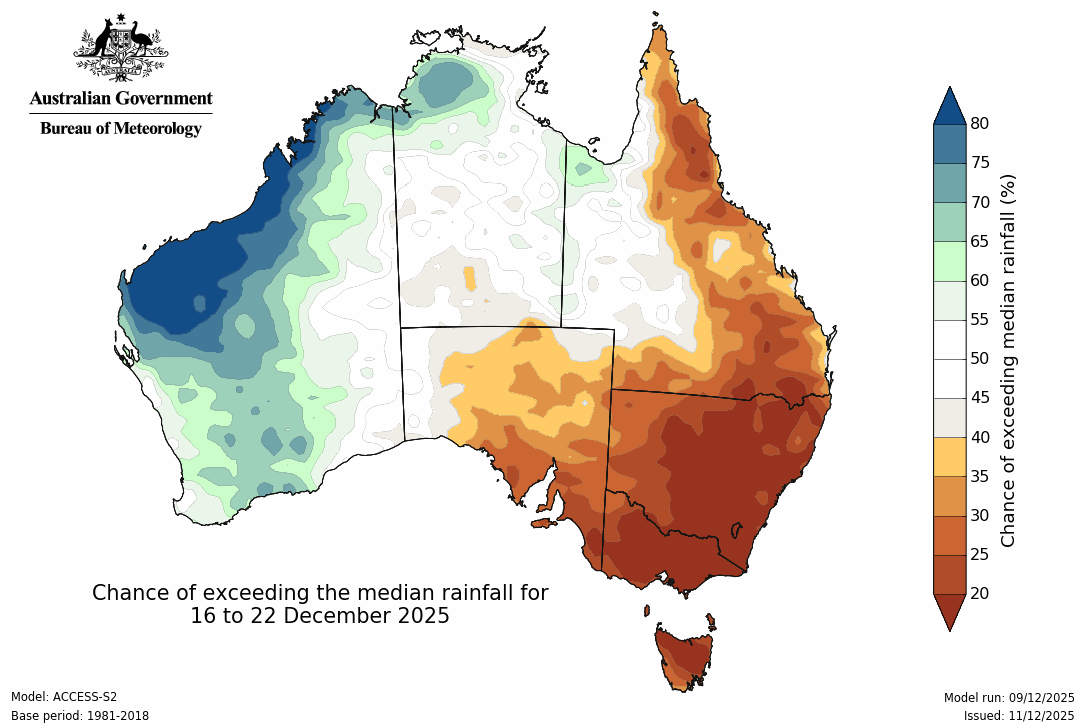
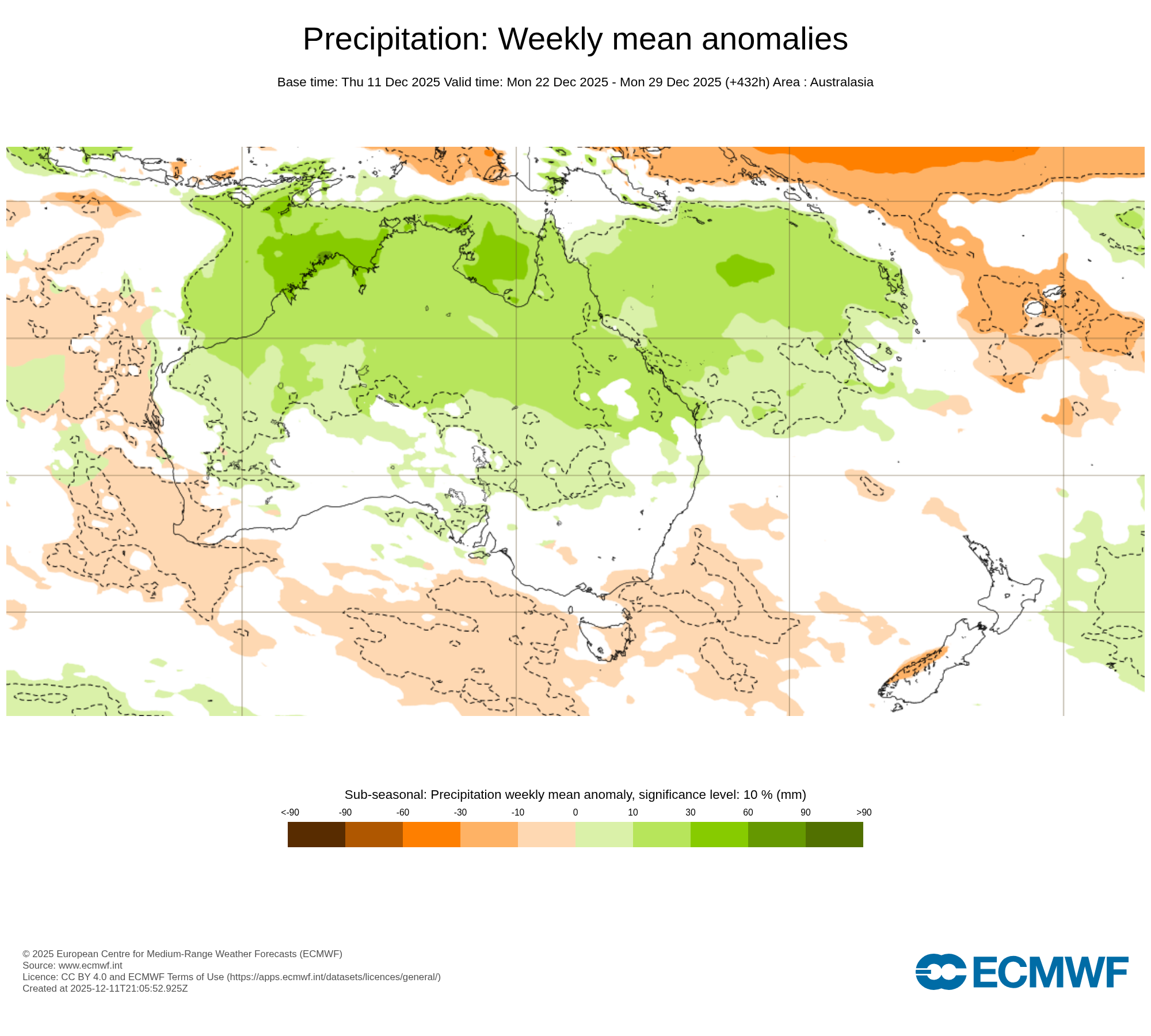
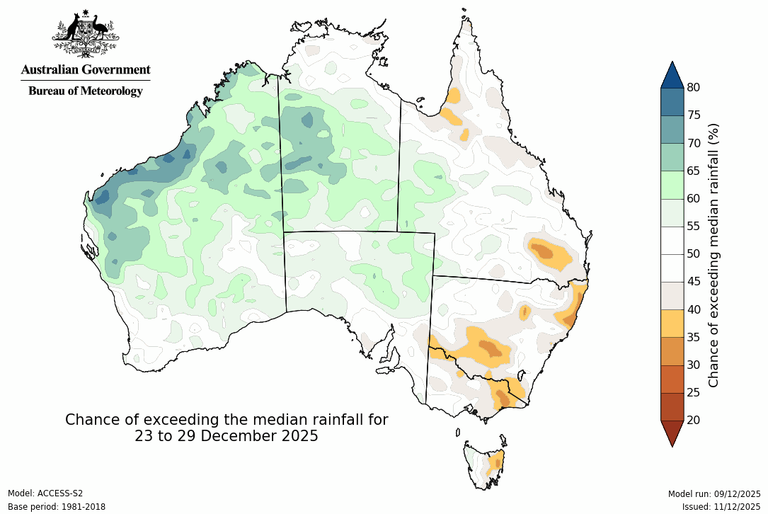
For the week of Christmas, Euro has a very tropical pattern, with rain confined to the northern half of the country. BoM is slightly different, pushing it down into the south of WA and SA.
In this series I'll take you through the drivers of our weather, highlighting any changes over time and things to watch out for (generally every Sunday). It covers weather elements like temperature and rainfall, and how they are driven by moisture from the Pacific and Indian Oceans, as well as bursts of energy from low pressure (SAM and MJO).
See and hear my commentary as I take you through the weather pattern's effects on our rain and temperatures in detail over the next week, with a brief look at week 2 and beyond as well.
Plus what is driving our weather in the weeks and months ahead, with the latest on El Nino/La Nina, the Indian Ocean Dipole (IOD), the Southern Annular Mode (SAM controls our weather systems), and the Madden Julian Oscillation (MJO connects tropical moisture to our weather systems).
I update this commentary each week, generally on Sundays. Make sure you are signed up (free or a subscription) so you don't miss an update.
Stay up to date with the forecast specifically for your area in our hour by hour outlook for the next 10 days. Download our app for iPhone and Android.
As always, you can see each of these graphics as soon as they update, as well as more information about them under our Rain Outlook and Seasonal Outlook pages within Jane's Update, along with our Snow Forecast in the snow season.

For further insights specifically for agriculture, to improve the utilisation of your resources, tailored to any Australian location, please upgrade your membership. You can take advantage of our free 30 day trial.
Upgrade to see full insights to help plan the best use for your resources:
- frost risk
- spraying conditions
- evapotranspiration to efficiently manage available water for crops
- growing degree days to monitor growth
- full ten day hour by hour outlooks, all variables, and all model data
- customised alert notifications
.png)
.png)
.png)