.png)
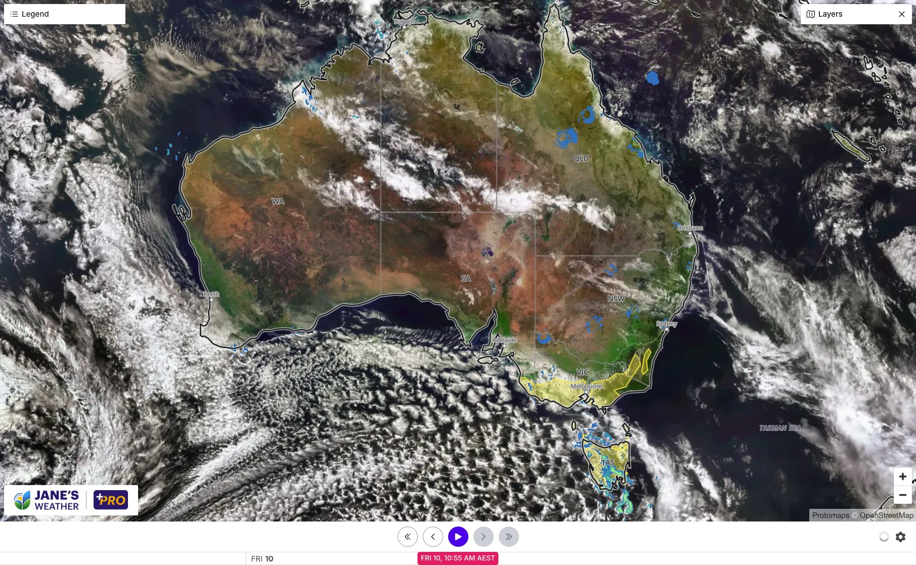
As we end the week there is a significant pool of cold air over the Bight that is ready to pounce on the southeast. You can see it by the speckled cloud on the satellite. This is going to have several impacts over the weekend and early next week.
That speckled cloud indicates not just cold air, but energy in the upper levels of the atmosphere. Energy is a key component to our weather systems - and the impact can be felt thousands of kilometres away.
Firstly, the cold outbreak moves across the southeast on the weekend. Felt in Tasmania from Saturday (with snow as low as 600-700 metres), and on the southeast mainland on Sunday - Sunday will deteriorate as it goes on and it'll be freezing by the end of it.
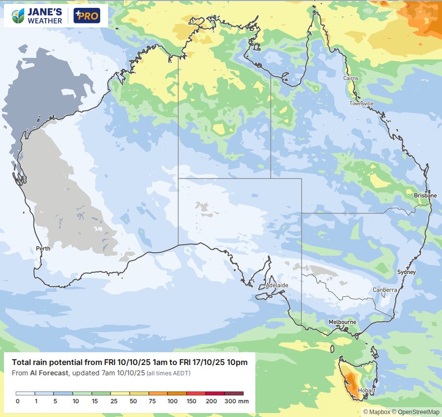
Meanwhile, moisture builds over the interior of the country and the energy from the cold outbreak is the catalyst it needs to turn that moisture into widespread rain. It will cross the interior, southern Queensland and northern NSW later in the weekend into early next week.
That's two weather systems working together - but the results remain very separated. Southern NSW, northern VIC and much of SA won't see any significant wet weather - most are set for less than a millimetre, stuck in the gap between the two systems.
.gif)
The cold outbreak cools things down in the east, extending right up to southern Queensland early next week - but the next burst of heat quickly begins in the west.
This one will skip the southwest corner - no big spikes of heat there yet.
Instead it will steadily move eastwards across the country, significantly raising temperatures, before the next cool change arrives a few days later.
.gif)
As we look ahead to the following week, there is the chance of a new burst of rain in the north, spreading down into southern WA and SA. This is one to watch beginning Monday 20th October - especially to see if it heads further eastwards after that.
For my full analysis don't miss this week's video update, perfect if you have 12 minutes to spare:
In this series I'll take you through the drivers of our weather, highlighting any changes over time and things to watch out for (generally every Sunday). It covers weather elements like temperature and rainfall, and how they are driven by moisture from the Pacific and Indian Oceans, as well as bursts of energy from low pressure (SAM and MJO).
See and hear my commentary as I take you through the weather pattern's effects on our rain and temperatures in detail over the next week, with a brief look at week 2 and beyond as well.
Plus what is driving our weather in the weeks and months ahead, with the latest on El Nino/La Nina, the Indian Ocean Dipole (IOD), the Southern Annular Mode (SAM controls our weather systems), and the Madden Julian Oscillation (MJO connects tropical moisture to our weather systems).
I update this commentary each week, generally on Sundays. Make sure you are signed up (free or a subscription) so you don't miss an update.
Stay up to date with the forecast specifically for your area in our hour by hour outlook for the next 10 days. Download our app for iPhone and Android.
As always, you can see each of these graphics as soon as they update, as well as more information about them under our Rain Outlook and Seasonal Outlook pages within Jane's Update, along with our Snow Forecast in the snow season.

For further insights specifically for agriculture, to improve the utilisation of your resources, tailored to any Australian location, please upgrade your membership. You can take advantage of our free 30 day trial.
Upgrade to see full insights to help plan the best use for your resources:
- frost risk
- spraying conditions
- evapotranspiration to efficiently manage available water for crops
- growing degree days to monitor growth
- full ten day hour by hour outlooks, all variables, and all model data
- customised alert notifications
.png)
.png)
.png)