.png)
A cold outbreak will affect the southeast this weekend. Properly cold, with air coming up from near Antarctica. This will produce showers tending to areas of rain, wintry hail, low level snow and biting winds.
Meanwhile, conditions are looking quite pleasant from Sydney to Brisbane and further north, and over into the southwest. On the weekend the cold outbreak has just the southeast in its path.
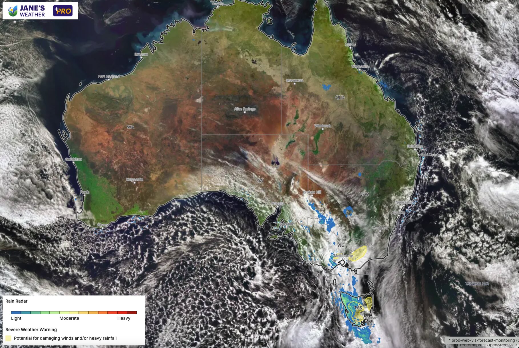
You can see just how cold the air is by the large pool of speckled cloud over the Bight:
The latest guidance shows that the second surge is likely to move across southeast SA, western VIC and western NSW on Sunday - skipping Tasmania and eastern VIC where it is cold but not as wet.
As we go into next week the cold pool (which you can think of as a ball of energy) interacts with moisture from the oceans to our east, producing a lengthy stretch of wet weather in eastern NSW and southeast QLD.
So, the weekend is nice in eastern NSW and southeast QLD, then it turns wet next week. While the weekend is cold and wintry in the southeast, before a stretch of frosty nights and sunny days next week.
In the west, the next big weather system arrives on Tuesday/Wednesday.
This is a feed of moisture from the Indian Ocean, running into strong low pressure, slowly moving and delivering widespread significant rain.
This weather pattern means that next week has the wet weather very focused on the east and west while it is dry in between.
However, in week 2 (beginning Monday 25th August), there are signs that the big system in the west could make its way into the southeast -> so that is one to watch out for on the horizon.
.gif)
If you'd like to be guided through all of this and have 12 minutes to spare, please see my latest video:
In this series I'll take you through the drivers of our weather, highlighting any changes over time and things to watch out for (generally every Sunday). It covers weather elements like temperature and rainfall, and how they are driven by moisture from the Pacific and Indian Oceans, as well as bursts of energy from low pressure (SAM and MJO).
See and hear my commentary as I take you through the weather pattern's effects on our rain and temperatures in detail over the next week, with a brief look at week 2 and beyond as well.
Plus what is driving our weather in the weeks and months ahead, with the latest on El Nino/La Nina, the Indian Ocean Dipole (IOD), the Southern Annular Mode (SAM controls our weather systems), and the Madden Julian Oscillation (MJO connects tropical moisture to our weather systems).
I update this commentary each week, generally on Sundays. Make sure you are signed up (free or a subscription) so you don't miss an update.
Stay up to date with the forecast specifically for your area in our hour by hour outlook for the next 10 days. Download our app for iPhone and Android.
As always, you can see each of these graphics as soon as they update, as well as more information about them under our Rain Outlook and Seasonal Outlook pages within Jane's Update, along with our Snow Forecast in the snow season.

For further insights specifically for agriculture, to improve the utilisation of your resources, tailored to any Australian location, please upgrade your membership. You can take advantage of our free 30 day trial.
Upgrade to see full insights to help plan the best use for your resources:
- frost risk
- spraying conditions
- evapotranspiration to efficiently manage available water for crops
- growing degree days to monitor growth
- full ten day hour by hour outlooks, all variables, and all model data
- customised alert notifications
.png)
.png)
.png)