.png)
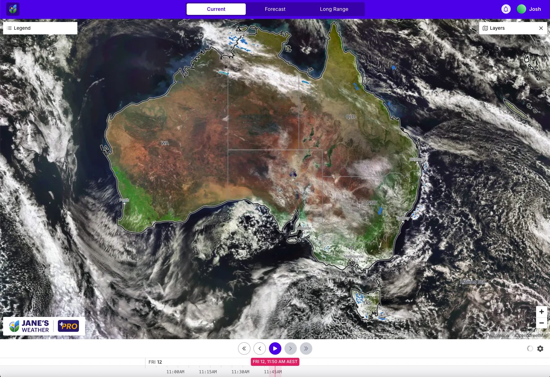
The major rain system that crossed NSW this week is over New Zealand on Friday with no further effects for Australia.
It delivered big falls, widespread rain, centred over NSW, as that is where the moisture and low pressure collided, driven by a low that crossed NSW. Whoever is in the path of low pressure gets the rain.

Today we have a weak disturbance crossing the southeast and a little rain in the Top End.
Over the next week we have weather systems crossing southern Australia while showers affect northeast QLD day after day all the way through.
The southern weather systems are cold fronts. These differ from a cut-off low pressure system, as they move faster and usually don't deliver as much rain.
The first collection of cold fronts crosses the southwest on the weekend, reaching the southeast on Monday/Tuesday. The second cold front crosses the southwest next Wednesday, reaching the southeast from Friday. In between these the weather pattern lets it warm up, sometimes quite significantly.

The Pacific Ocean Index has bobbed around just under zero for the past few months. The spread of the different models is still wide indicating low confidence in the forecast. One set of modelling has it crossing the La Nina threshold in October, while the others keep it Neutral, but all on the Negative side of Neutral.
We also have warm water off the coast of Queensland, so we have a source of moisture from the Pacific no matter what happens across the basin.
.jpg)
The Indian Ocean Index is currently in a strong Negative Indian Ocean Dipole (IOD). This week's rain system is a classic example of how this phase helps it rain, with tropical moisture pouring in from the Indian Ocean in a juicy northwest cloudband, running into low pressure and delivering widespread rain.
But as always, you need low pressure to complete that transformation into rain, and where the low moves is who gets the rain.
.jpg)
For the full update, don't miss this week's video, perfect if you have 12 minutes to spare:
In this series I'll take you through the drivers of our weather, highlighting any changes over time and things to watch out for (generally every Sunday). It covers weather elements like temperature and rainfall, and how they are driven by moisture from the Pacific and Indian Oceans, as well as bursts of energy from low pressure (SAM and MJO).
See and hear my commentary as I take you through the weather pattern's effects on our rain and temperatures in detail over the next week, with a brief look at week 2 and beyond as well.
Plus what is driving our weather in the weeks and months ahead, with the latest on El Nino/La Nina, the Indian Ocean Dipole (IOD), the Southern Annular Mode (SAM controls our weather systems), and the Madden Julian Oscillation (MJO connects tropical moisture to our weather systems).
I update this commentary each week, generally on Sundays. Make sure you are signed up (free or a subscription) so you don't miss an update.
Stay up to date with the forecast specifically for your area in our hour by hour outlook for the next 10 days. Download our app for iPhone and Android.
As always, you can see each of these graphics as soon as they update, as well as more information about them under our Rain Outlook and Seasonal Outlook pages within Jane's Update, along with our Snow Forecast in the snow season.

For further insights specifically for agriculture, to improve the utilisation of your resources, tailored to any Australian location, please upgrade your membership. You can take advantage of our free 30 day trial.
Upgrade to see full insights to help plan the best use for your resources:
- frost risk
- spraying conditions
- evapotranspiration to efficiently manage available water for crops
- growing degree days to monitor growth
- full ten day hour by hour outlooks, all variables, and all model data
- customised alert notifications
.png)
.png)
.png)