
.png)

The weather pattern has aligned perfectly to produce day after day of wet weather in southeast Queensland and much of eastern NSW.
A high over the Tasman Sea is very slow moving, bringing distinctly different weather from Shepparton to Scone.
One has a stretch of frosty mornings and sunny afternoons that slowly warm up (Shepparton) while the other has showers tending to steady rain with the risk of heavy thunderstorms. One has recorded 13mm of rain this month (Shepparton) while the other could see several times that in just a few days (Scone).
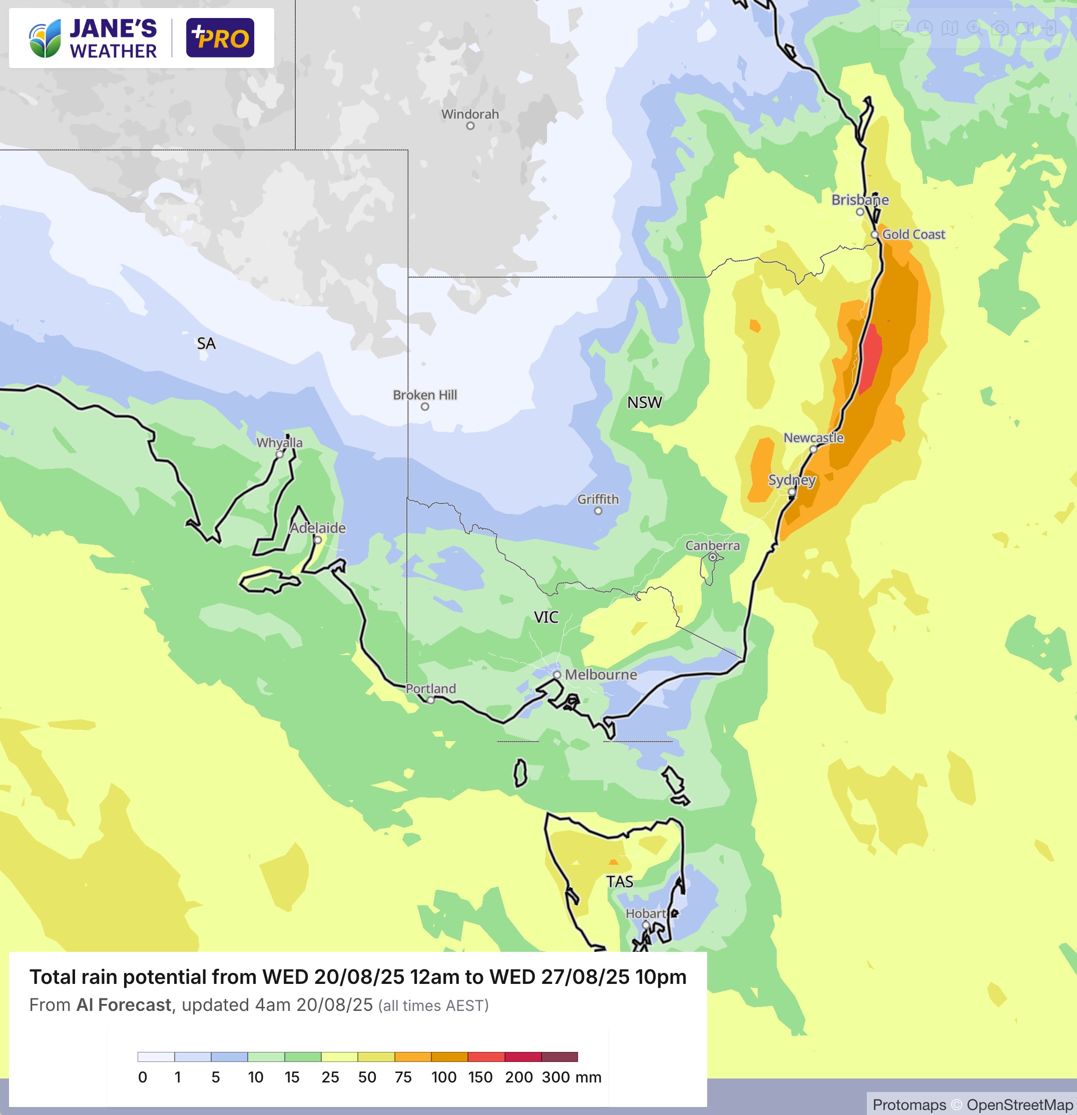
Parts of eastern NSW and southeast Queensland are likely to record more than 100mm, and much of northeast NSW is under flood watch with already soaked catchments. Conversely, parts of South Australia, Victoria, Tasmania and southwest NSW are still in drought, in our land of droughts and flooding rains.
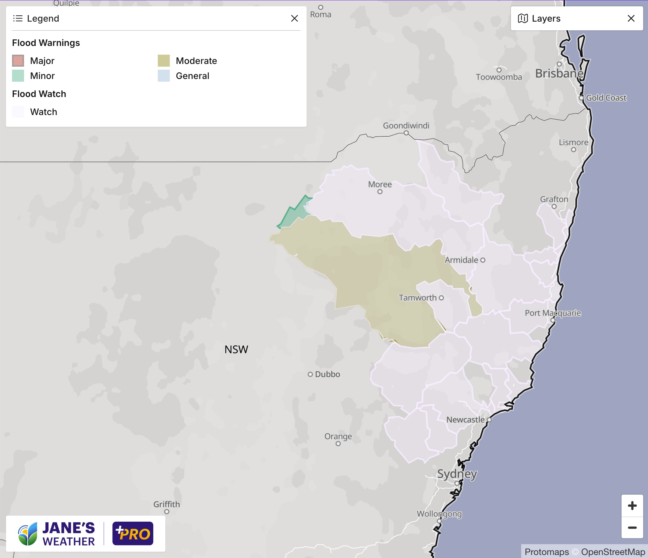
The positioning of the high means that moist air from the ocean to our east is pushed onto the land and runs into an area of instability, with rain extending inland across the ranges to the western slopes and plains. Those winds run out of moisture as they wrap around and head into southwestern NSW and Victoria.
The pattern changes at the end of the week, easing the rain as a cold front crosses the Bight. That front delivered significant rain to Western Australia on its way through, but it won’t do the same for the southeast on Friday and Saturday. Again, the culprit is high pressure. It’s acting like a block, not letting any weather systems arrive with gusto. There is a little bit of rain, essentially the ‘left overs’, but that is all.
Let’s jump ahead to next week.
If you’re in the southeast looking for rain then I have good news as the weather pattern is looking a lot kinder.
As flagged in my weekly update last Friday, ‘week 2’ has the potential to send a rain system into the southeast.
The latest guidance has this materialising, with a feed of moisture from the Indian Ocean in the shape of a juicy northwest cloudband. High pressure disappears, paving the way for low pressure to deliver that rain to the southeast.
It all begins on about Tuesday 26th, and may continue through the rest of the week - but you’ll see the cloudband developing over the weekend to let you know it is on its way.
Keep up to date with forecasts to see the latest guidance on how much rain is coming your way.

.png)
.png)