
.png)

The classic rainfall equation will be properly in action this week, as moisture and instability come together to produce widespread rainfall.
Let's set the scene with the latest weather pattern.
I know we're interested in low pressure (the fronts, troughs and lows that represent the instability part of the rain equation) - but I encourage you to look where the highs are first. One over the Tasman Sea (between Victoria and NZ) and the other off the coast of Perth.
If you want widespread rain, that is a great place to start.
That positioning indicates that the highs have split. No longer a big ridge of them sitting across the country, acting like a block.
The split means that moisture from the tropics can surge across the country, run into low pressure and bring rain to all in its path.
Today, that's moisture from the Indian Ocean that is feeding into a trough and cold front in the west, all driven by a low south of the Bight:
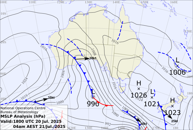
This low is going to remain to our south, pushing the cold front into the east as we go through the first part of this week. This should bring decent rain to every state and territory.
But there's more. That's just the first one.
We'll do it again in the second half of the week and across the weekend - and this next one is bigger.
The highs split again, and the next cold front sucks in that moisture from the Indian Ocean, in a juicy northwest cloudband.
The low that drives this one takes a better path for us. No longer well to the south of the mainland, this low should be around Adelaide on Friday night, Bass Strait (between VIC and TAS) on Saturday night, and southeast of TAS on Sunday night.
And that positioning ensures that a huge rainband moves across the country - starting in southwest WA, crossing the centre/SA then drenching the east - stretching from the top of QLD to the bottom of TAS.
Everywhere on this map that is yellow is at least 25mm of rain:
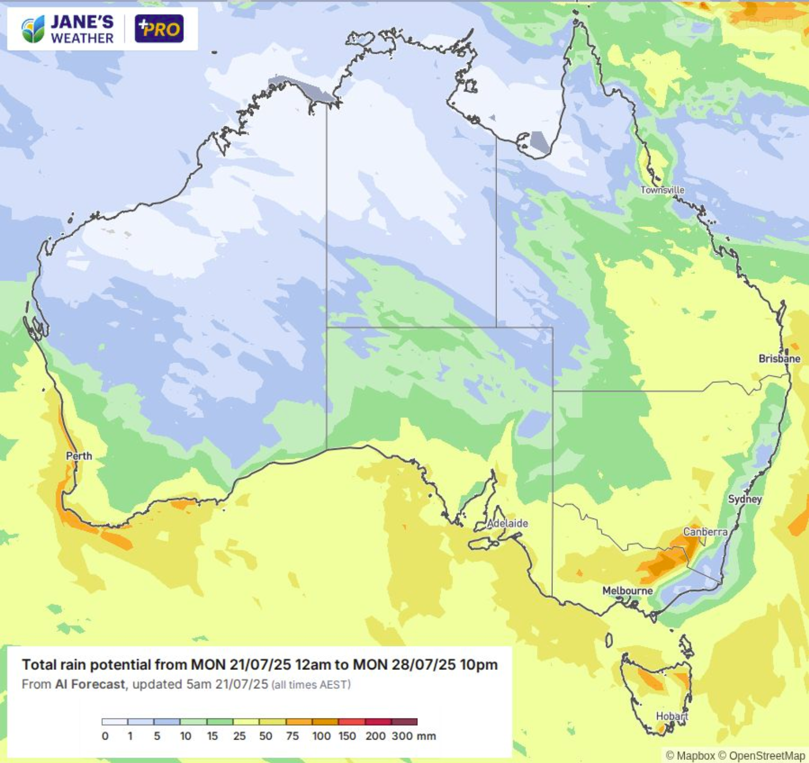
The path of the low means that this isn't for coastal NSW or southeast VIC.
Then there are signs of yet another wave of rain beginning in the west early next week.
The Negative Indian Ocean Dipole is starting to make its presence felt!
.png)
.png)
.png)