Weekly Weather Outlook
There are two main areas of active rainfall to watch this week.
Northern Australia
The first is across the north of the country, particularly the Northern Territory and far northern Western Australia. A low-pressure trough will remain active across this region throughout the week, bringing regular rainfall.
From the middle to latter part of the week, much of this rainfall is expected to be associated with potentially strong thunderstorms. Heatwave conditions are also forecast across parts of the north, with warnings in place.
Southeast Australia
Further east, conditions will be considerably more active.
A cold front will move across Victoria and Tasmania on Monday before shifting into the Tasman Sea on Tuesday. This system is expected to bring widespread coastal rainfall, along with the potential for thunderstorms on both Monday and Tuesday.
Following the passage of the front, a high-pressure system will establish itself, bringing more settled conditions overall. However, some rainfall will continue along coastal areas, while inland regions are expected to remain dry throughout the week.
Another rainfall system is forecast to approach southeastern Australia later in the week, potentially arriving on Friday or Saturday. Southern Victoria may also see further rainfall towards the end of the week.
Southwest Australia
Across the southwest, conditions will remain relatively dry and stable for most of the week. Temperatures will be generally mild and consistent, with a gradual warm-up expected as the week progresses.
Climate Drivers and Seasonal Outlook
Looking back at October, rainfall was relatively high across much of the country, while temperatures were also warmer than average across most regions.
Looking ahead to November, the outlook continues to favour warmer-than-average temperatures. However, this signal is not quite as strong as some of the seasonal outlooks suggested earlier in the year.
We are also monitoring the key climate drivers, particularly the Southern Annular Mode (SAM), which is trending towards more positive conditions.
This is favouring an increase in low-pressure systems and trough activity. As a result, we are seeing a greater tendency towards longer-lasting, soaking rainfall events, rather than the shorter and more transient rainfall typically associated with passing cold fronts.
That's all for this week's weather update. Stay safe, have a great week, and we'll see you next time!
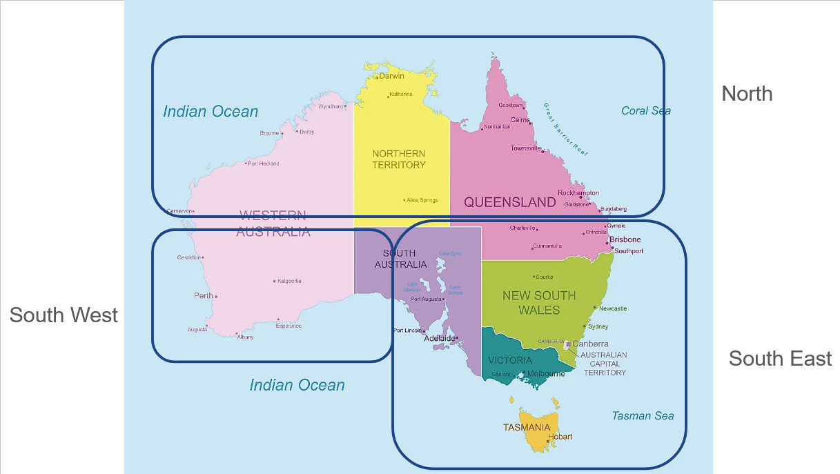
One final update: We've now introduced three consistent regional weather forecast videos each week. Take a look at the image below to see which video is most relevant to your region and where to tune in.