
.png)

The beginning to middle of the week is fairly quiet across the country. Cold fronts will be the main feature, affecting parts of the south.
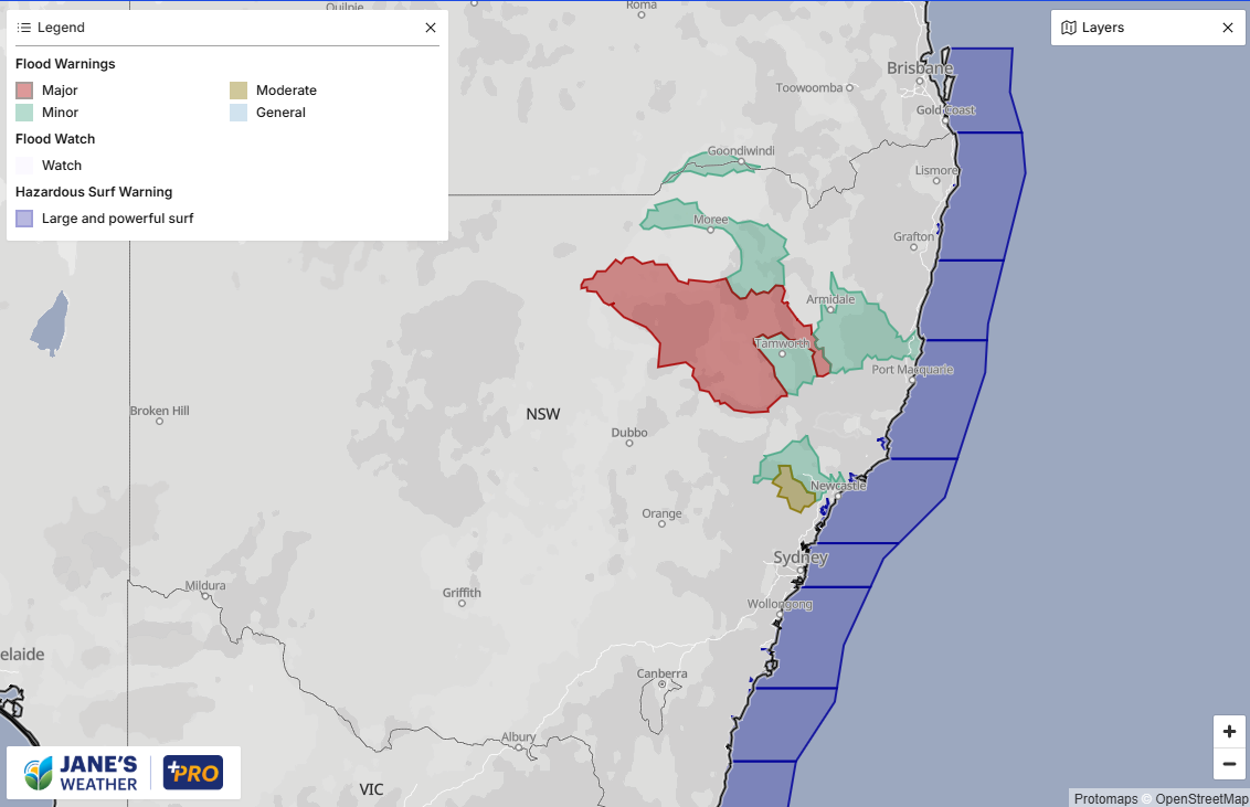
High pressure brings a well deserved break to NSW and Queensland, with lighter winds and sunshine. The snow has melted in Armidale, and the lack of further rain will be a relief for the major flooding in the Namoi River near Gunnedah. The current warnings as of 5pm on Monday:
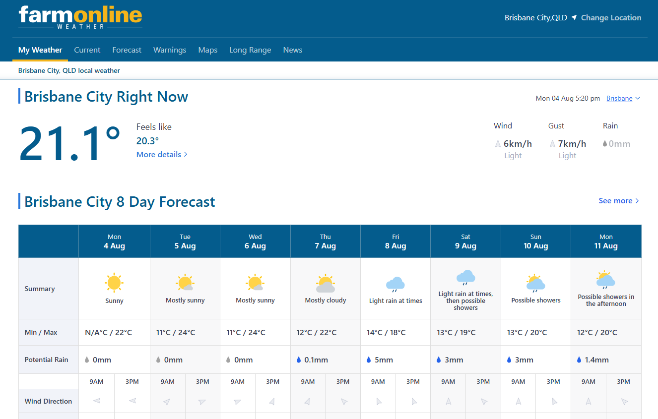
The next stretch is lovely for this time of year - Brisbane even reaches the mid-20s in the sunshine. The next wave of wet weather doesn't arrive there until the end of the week:
The focus from Tuesday to Thursday is in the south - and there isn't much.
High pressure is making cold fronts slide across the southeast, so they only bring a few millimetres, slightly more in exposed areas, but nothing significant.
A front slides over the southeast early on Tuesday as the next one crosses the Bight. Then that front slides across the southeast on Wednesday, and high pressure has moved to the southeast by Thursday.
.gif)
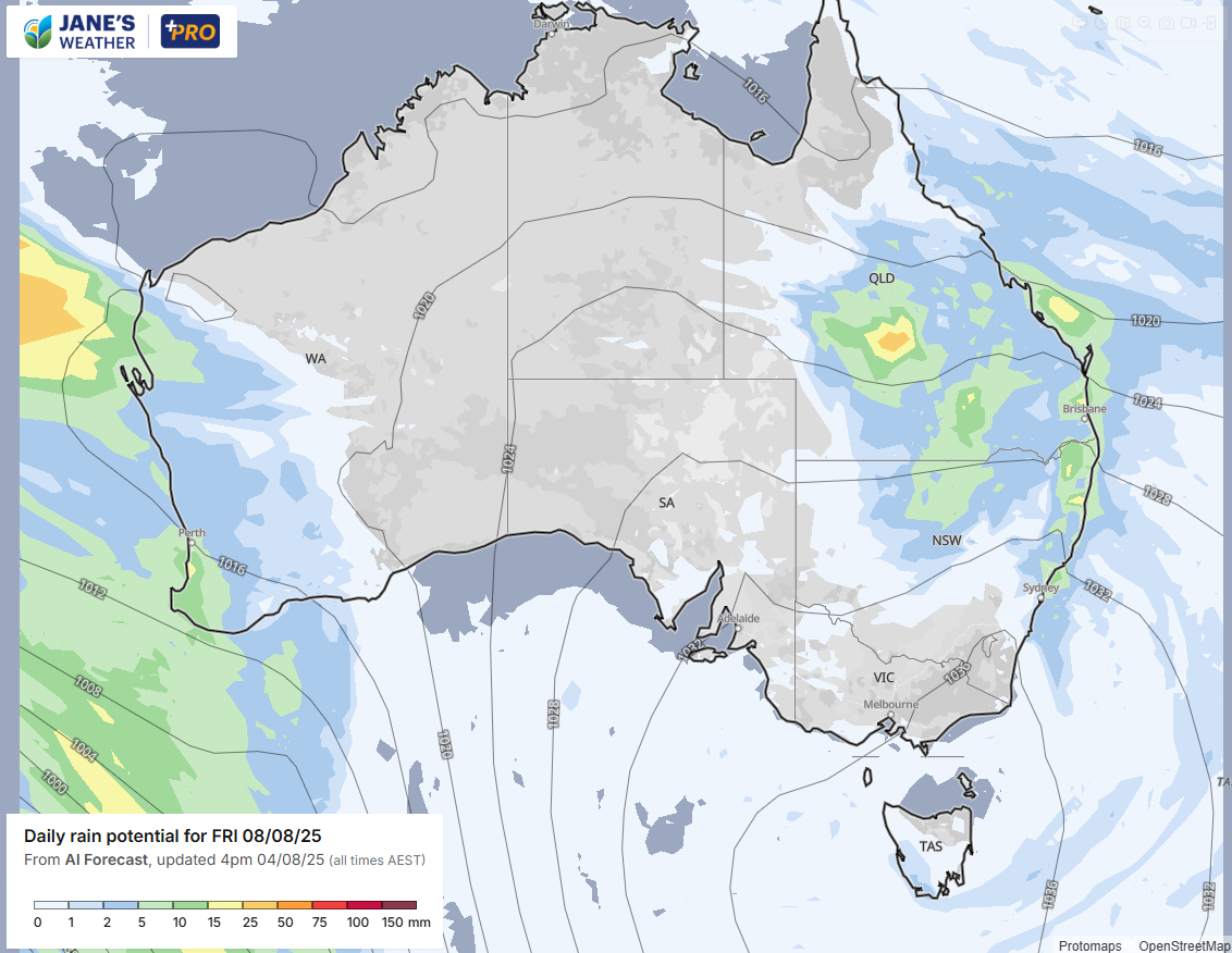
Things ramp up again at the end of the week - in both the west and east.
The area of light rain you can see over the interior on Thursday (in the map above) is a feed of tropical moisture from the Indian Ocean crossing the country. High pressure moving to the southeast pushes tropical moisture from the Pacific Ocean into Queensland - and these meet up with a trough to produce widespread wet weather.
Meanwhile, the next front, with a feed of Indian Ocean moisture, arrives in the west on Friday.


.png)