
.png)

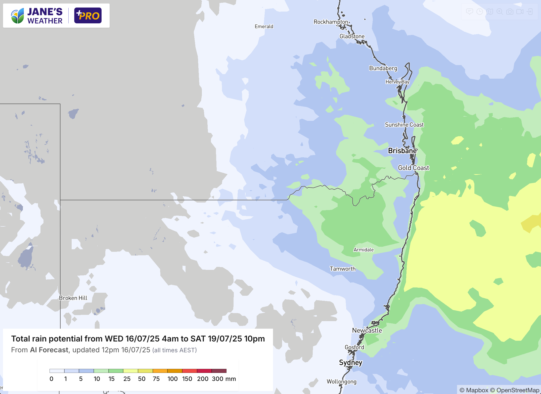
As a series of cold fronts continues to affect the south, there is an out of season rain system gearing up for southeast Queensland and northeast NSW.
Likely to bring 5 to 25 mm across the area, starting later on Thursday, continuing on Friday and clearing early on Saturday.
Extending inland, but not quite making it to areas like Emerald, Charleville, Bourke or Dubbo - with the outer bands of rain just brushing these parts.
Coastal areas should see the wet weather continuing until early next week thanks to stream showers in onshore winds.
Meanwhile, these southern fronts are about to get a shake up.
In order to make it rain you need to have two things work together - moisture and instability.
The southern coastline has had plenty of instability with a new front passing by every day or two in this series, but the moisture part has been missing a key ingredient.
Temperatures in the Southern Ocean are around 10C. That provides a little bit of moisture to the atmosphere. Temperatures off the northern part of the country are up near 26C. That provides a whole lot of moisture to the atmosphere.
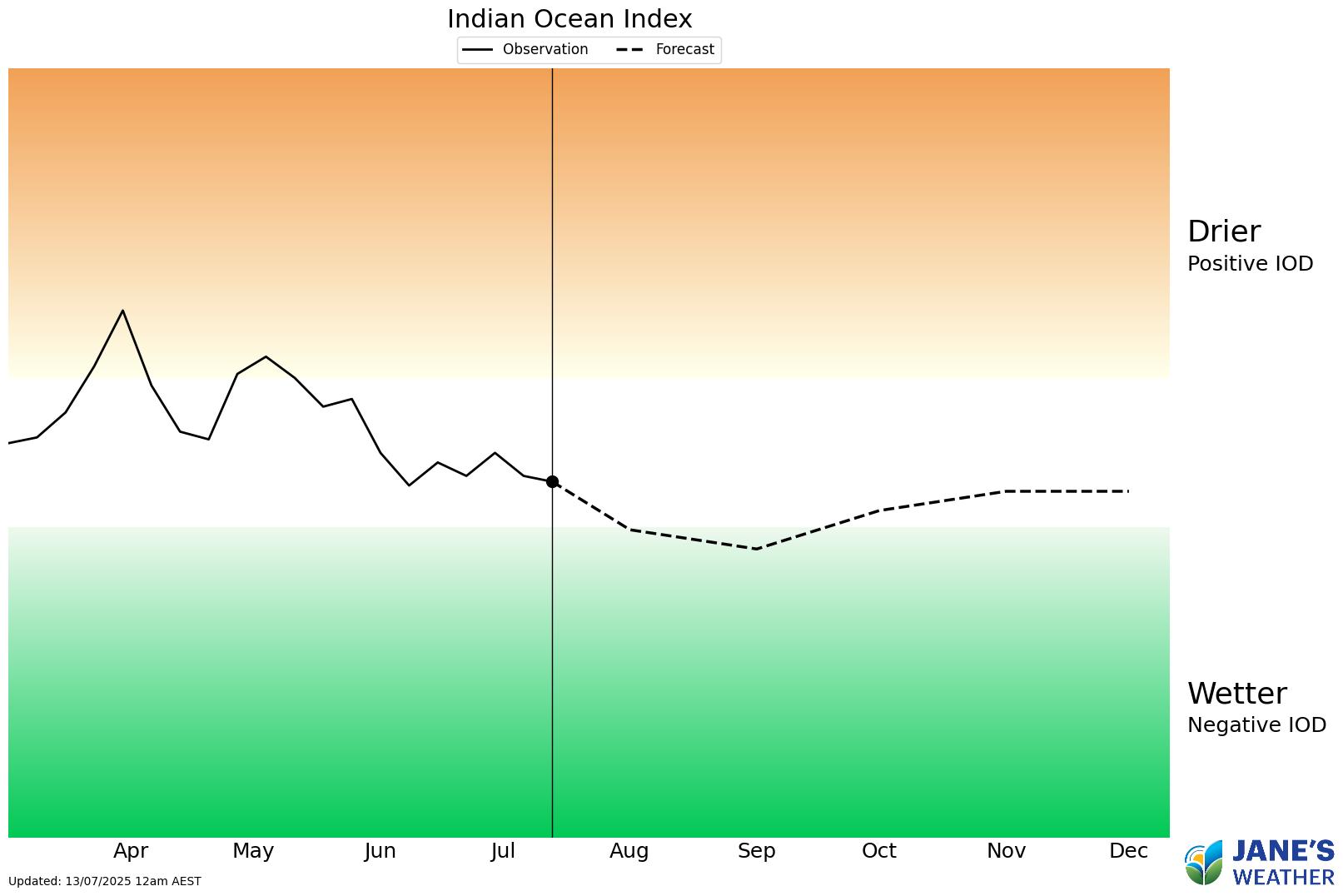
This moisture source is always there, increasing when waters are warmer than average, and decreasing when colder - but in order to access it, the moist air needs to be pushed into Australia. A La Nina helps this occur, with moisture from the Pacific Ocean, and a Negative Indian Ocean Dipole (IOD) helps this from the west.
We’re about to see a classic example of that: the northwest cloudband. I often call it a juicy, northwest cloudband, because these features are laden with moisture and that key ingredient is surging across the country.
The moisture has to meet up with instability, from a trough, cold front or low - and wherever that weather system travels, those in its path soak up the rain.
Next week, and possibly repeating in the following week, we’re likely to see widespread rain, pushed into the areas that get the low pressure.
This is a great example of the developing Negative IOD. Another is the never ending series of cold fronts across the south, thanks to high pressure no longer acting like a block. These blockers have prolonged the drought over the southeast for the past 18 months, and the developing Negative IOD could be one of the instigators for the return to regular rainfall.
There is always an exception - the rain is widespread but it won’t reach everyone. Some parts will miss out if the instability doesn’t suit that area, but overall, we’re about to go into a wet phase that delivers for much of the country.


.png)