
.png)

We have a big week of weather in store.
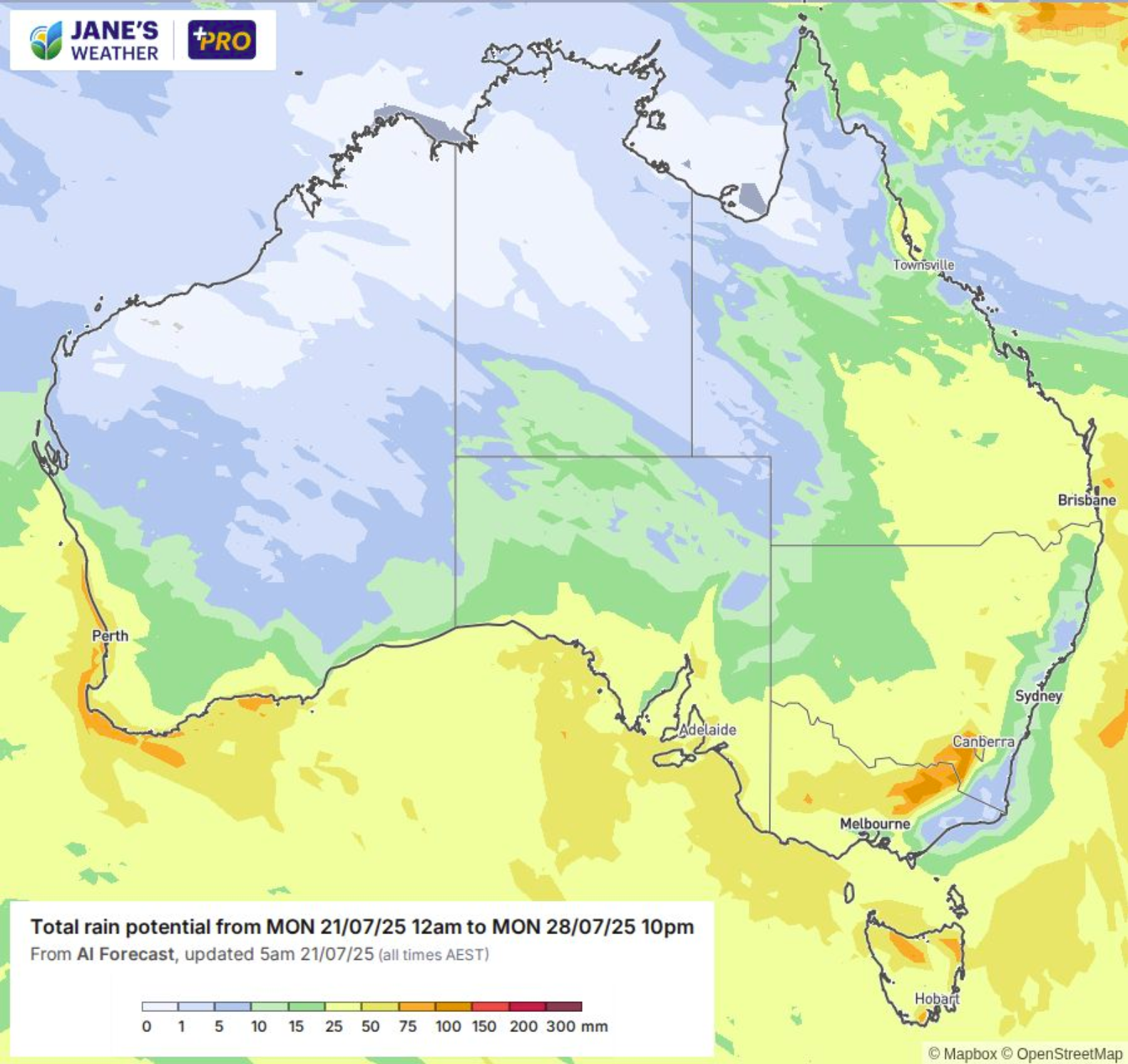
Two widespread rain systems are kicking off, set to spread rain across much of the country in an Australia-wide rainfall event. Moisture and instability are working together beautifully to soak the land, in a great sign that the Negative Indian Ocean Dipole is emerging.
But... a lot of this won't be cold enough for the alps.
There are huge precipitation totals coming our way (around the 100 to 150 mm mark), but each time they kick off, it won't be cold enough for snow.
The first one begins on Tuesday.
Rain falls during the day, when the heaviest falls occur, finally changing to snow in the evening (late at night in NSW) as the intensity eases. Lighter snow continues through Wednesday, easing on Thursday.
This one may bring 30 to 50 mm of rain, then up to 10 cm of snow.
The second one begins late on Friday. Rain falls during the day on Saturday, when the heaviest falls occur, finally changing to snow on Saturday night (possibly Saturday afternoon up high).
This one may bring another 30 to 50 mm of rain.
But things look better once the colder air arrives.
Moderate precipitation rates set in for Sunday, when it should be cold enough for snow to at least 1600 metres, hopefully 1500 or slightly lower. This is where we have the potential for 20 to 40 cm of snow (by the end of the weekend).
LOOKING FURTHER AHEAD
There may be yet another weather system - and at this stage, this one looks a lot better for the alps. No warm up, just snow... likely to stick around for Monday, Tuesday and Wednesday next week.
We'll have more details on this weather system when it gets closer.
.png)

