
.png)

In order to make it rain you need two key ingredients: instability and moisture. We have both of those working together in a spectacular way this week. For those in the path of the low pressure there is soaking rain coming your way.
The moisture is in the form of a northwest cloudband that acts like a slide, feeding moist air from over the Indian Ocean across the country.
The instability is from a low that interacts with that moisture and converts it into rain for those in its path.
MONDAY
On Monday we have the northwest cloudband kicking off, while the instability part is still over the Bight. The coloured areas indicate rain, and the coloured lines indicated how warm or cold the air is - cold air indicates lots of instability (and another cold outbreak for Tasmania with snow to around 600 metres or lower in the far south shown by the approaching purple line).

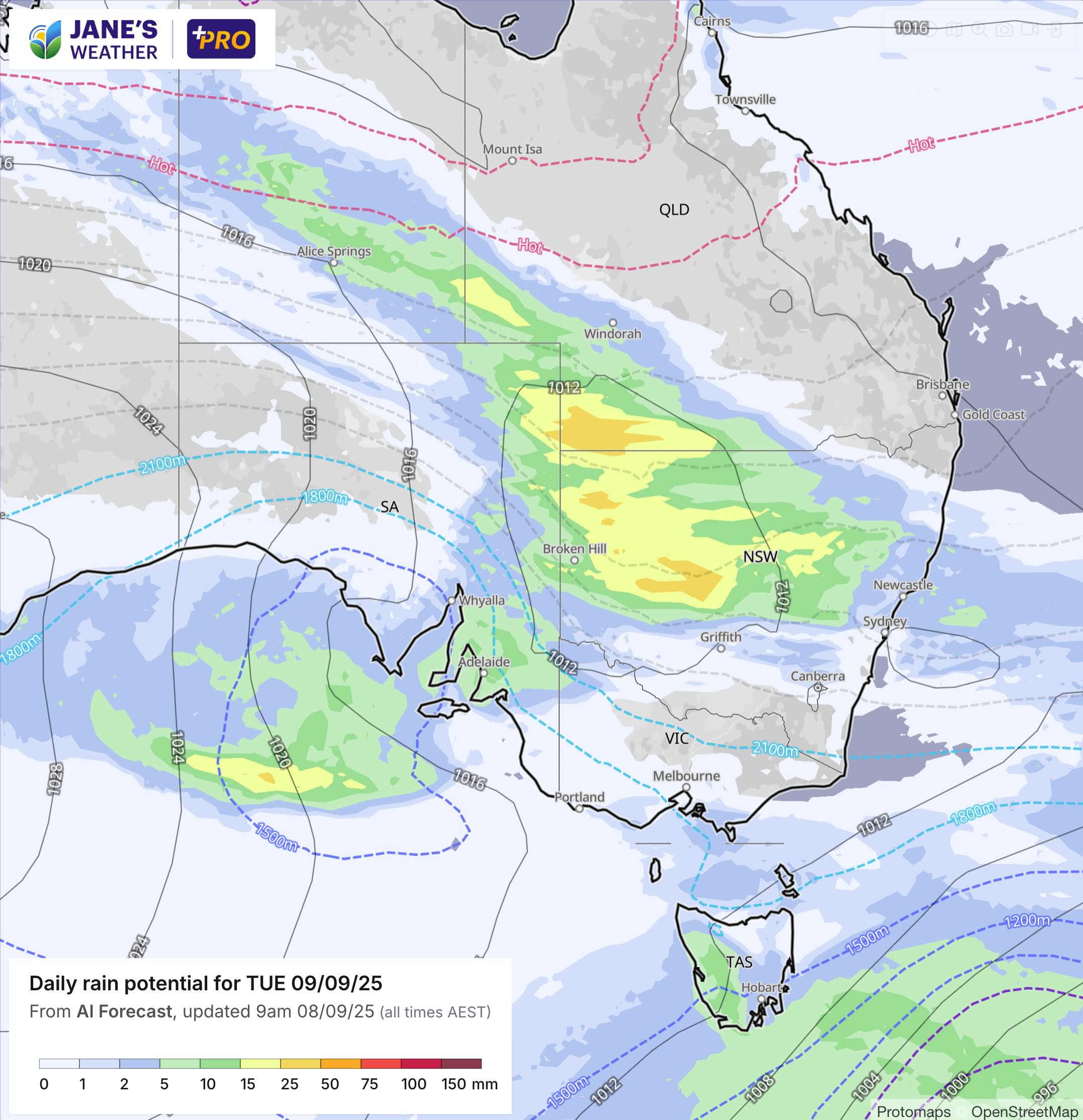
TUESDAY
On Tuesday the northwest cloudband really kicks into gear with a huge area of rain stretching across the NT and NSW into eastern SA. The instability driving this is still just west of Adelaide as the low forms over western NSW (encased by the 1012hPa grey line).
WEDNESDAY
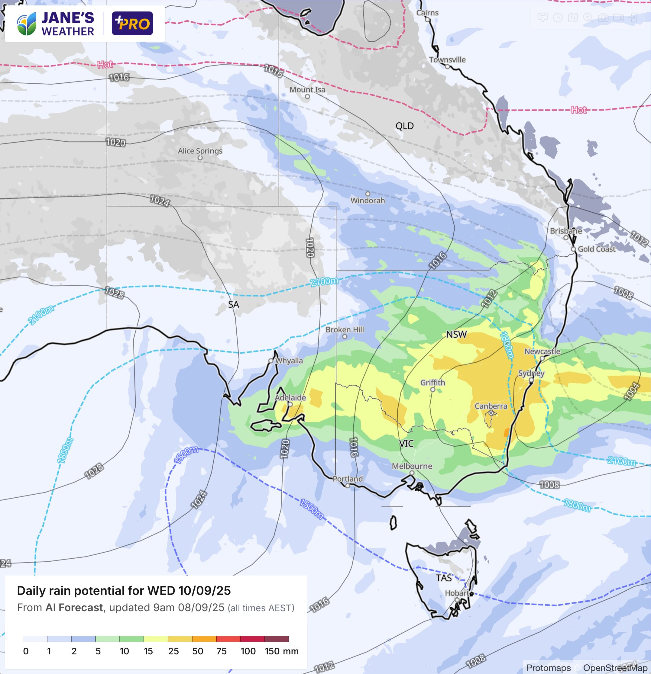
On Wednesday the rain hits southern QLD, western NSW, northern VIC and parts of southeastern SA. The rain also develops east of the ranges on the NSW coast south of Port Macquarie. The low is just off the coast of Newcastle, so the rain falls to the south of this point.
THURSDAY
On Thursday the low moves off the coast so the rain starts to ease. Fairly dry now over western/inland parts, with some rain left for the coast (and a weak front crossing the southeast).

TOTALS
Thanks to the path of the main area of low pressure (across NSW), western and southeastern NSW will do very well from this one.
Southwestern QLD is set for rain under the cloudband.
Parts of southeastern SA will do very well under the path of the low.
Northern VIC has good falls, but as the low takes a path over NSW, much of the south misses out.


.png)
