
.png)

It is very early in the season for Sydney to soar close to 40C. It is very early in the season for outback towns to crack 45C.
Spring is the fight between heat building in the north, and the chilly depths of winter deciding they are not quite done with us yet.
It is a time when parts of Australia that aren’t used to huge swings in temperature, go on a temperature roller coaster.
Returning to Sydney for a moment, consider that it was 36C on Monday, 24C on Tuesday, near 40C on Wednesday, and in the low 20s on Thursday. That’s one stomach lurching ride.
The Harbour City was at the mercy of the wind direction with heat pushed in on gusty northwest winds, offset by a cooler southeasterly on Tuesday, flicking back to gusty NW on Wednesday, then a cool change early Thursday.
Inland areas haven’t had that coastal reprieve in the middle - and parts of Queensland won’t see the cooler reprieve for a while.

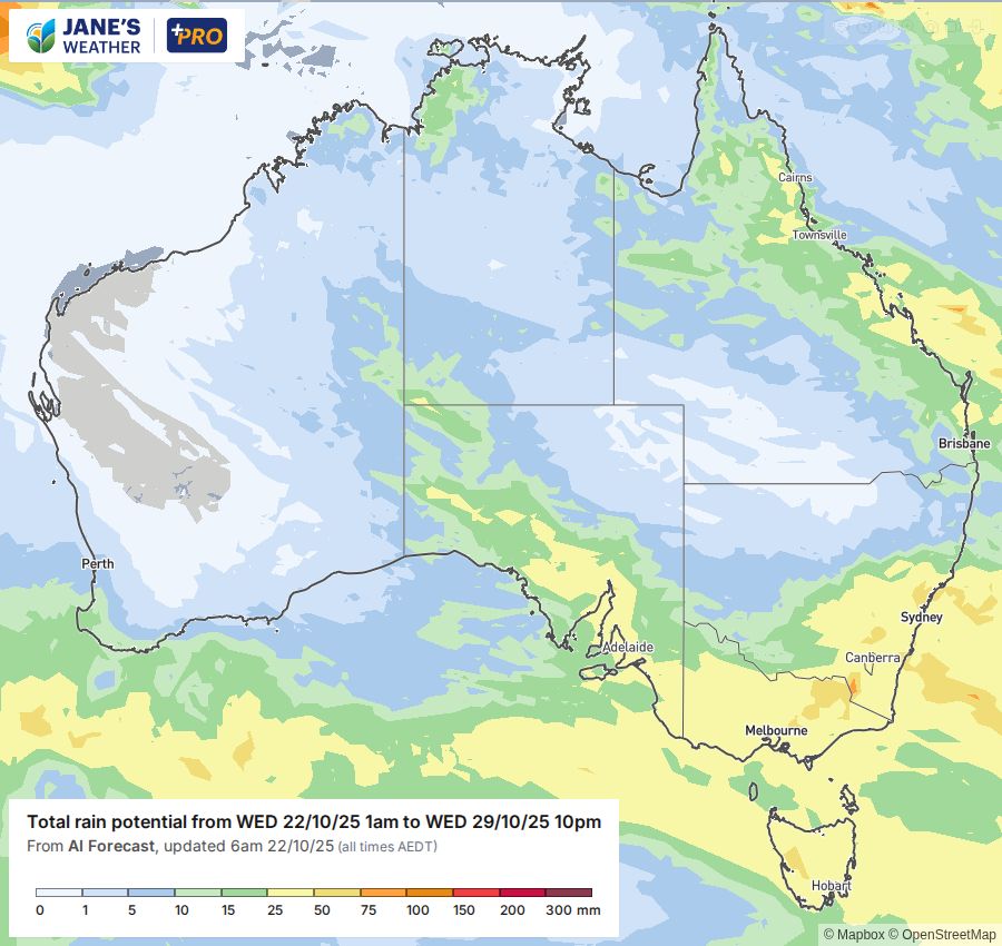
Meanwhile, there is a huge northwest cloudband, stretching from northern WA to the southeast, bringing rain.
This is driven by a low - the engine room that drives the huge weather system - passing close to the southeast SA and southwest VIC coasts, then crossing Tasmania.
Low pressure close to a coastline whips up wild winds, and causes havoc for those just to the western side of that low.
As we go into the weekend there is another huge cloudband brewing. This one is likely to take a similar path, spreading rain across a large part of southern Australia (and under the band that extends down from the northwest) on the weekend into early next week.
This is a rain event that takes a tour of Australia’s southern capitals, sightseeing through all the regional areas in between. Starting in Perth, and visiting Adelaide, Melbourne and Hobart on the weekend, then Canberra and Sydney early to mid week.
When the low pressure system moves close to a coastline it will wreak windy havoc, and could end spectacularly just off the coast of Sydney, drawing in even more moisture from the Pacific Ocean and turning that into significant rain.
This part of the weather system is driven by a feed of cold air from the south that could result in snow to low levels in Tasmania and Victoria early in the week - yes, even though it's the last week of October.
.png)

