
.png)

The next week has much of southern Australia going on a temperature rollercoaster, which is a very typical weather pattern for Spring.
Spring is known as the fight between hot and cold, as increased heating from the sun in the north wrestles with plenty of lingering cold air to the south. We see these clashes in the form of cold fronts (which, interestingly, were originally named after behaviour seen in WW1).
Hot air from the north begins to surge southwards at this time, brought on northerly winds ahead of an approaching cold front. These winds are often powerful and gusty as there is a tight pressure gradient ahead of the front, funnelling the winds and air to their new destination.
When the cold front crosses through it comes with a significant temperature drop, especially if the trajectory of the air in behind the front has taken a path from near Antarctica.
This weather pattern is how we get a day reaching 30C in Mildura in Victoria’s northwest, followed by snow falling to low levels in Tasmania the next day.
Our current weather pattern has the warmer winds reaching southeastern Australia at the end of the week, before colder air surges through. When it's cold on one side of the country, it is often hot on the other side - and that’s exactly the case this time as temperatures rise significantly in the west on the weekend.
Melbourne should rise to the mid-20s on Friday, then struggle to make the mid-teens on Saturday. Conversely, Perth is in the high-teens on Friday, then up in the high-20s by Sunday.
.gif)
These cold fronts don’t only bring a sharp change in temperature and howling winds (and the raised dust that comes with them in dry areas), but also a band of rain. If there is a connection to tropical moisture then that band is fed with moist air which the front can turn into heavier than usual rain.
The next one of these crosses much of Queensland, NSW, eastern SA, Victoria and Tasmania at the end of the week and into the weekend. Fed by moist air moving in between Darwin and Cairns, this particular weather system delivers the best falls for southeast Queensland and northeast NSW - west of the ranges rather than to the east. Western Tasmania will also do very well from this.
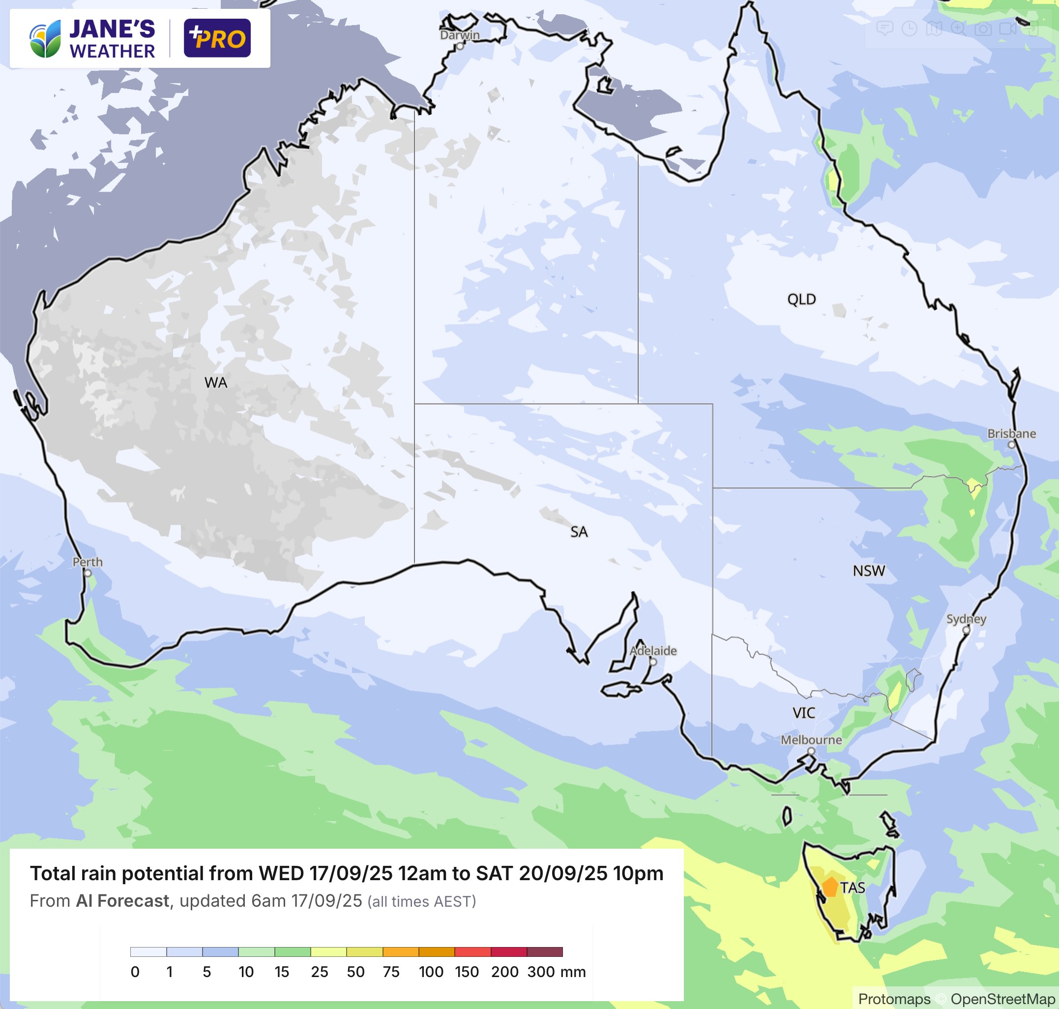
But it won’t be a repeat of the big weather system from last week, as the feed of moisture isn’t huge, and this isn’t a cut off low driving huge falls for those in its path - just a standard cold front.

.png)
.png)