
.png)

A cold front peaked over Western Australia on Sunday, crosses the South Australian coast on Monday, and slides over the southeast on Tuesday.
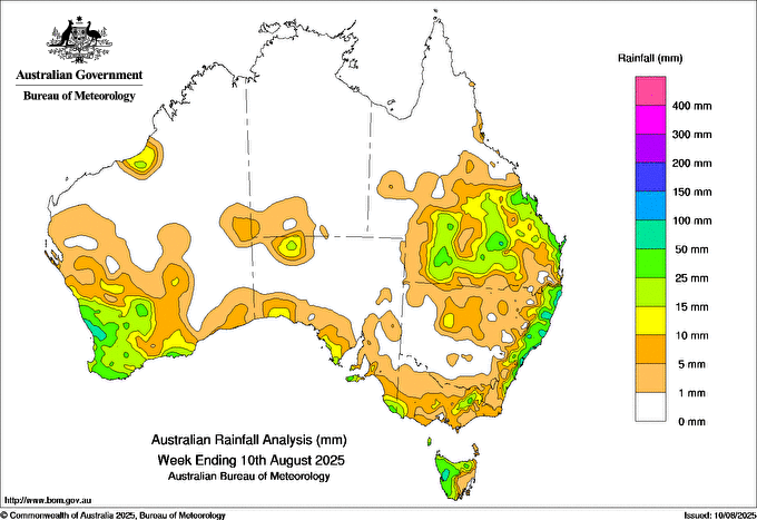
Parts of the west received just over 50mm as the strong front interacted with a feed of tropical moisture from the Indian Ocean. On Friday and Saturday there were significant totals over southern Queensland, northern NSW and (into Monday too) the NSW coast, from another weather system. In the southeast there wasn't much from last week's weather system, unless you were in an exposed or elevated spot:
The latest cold front won't deliver much to the southeast as it has lost it's connection to tropical moisture, and is losing it's instability as it slides through:
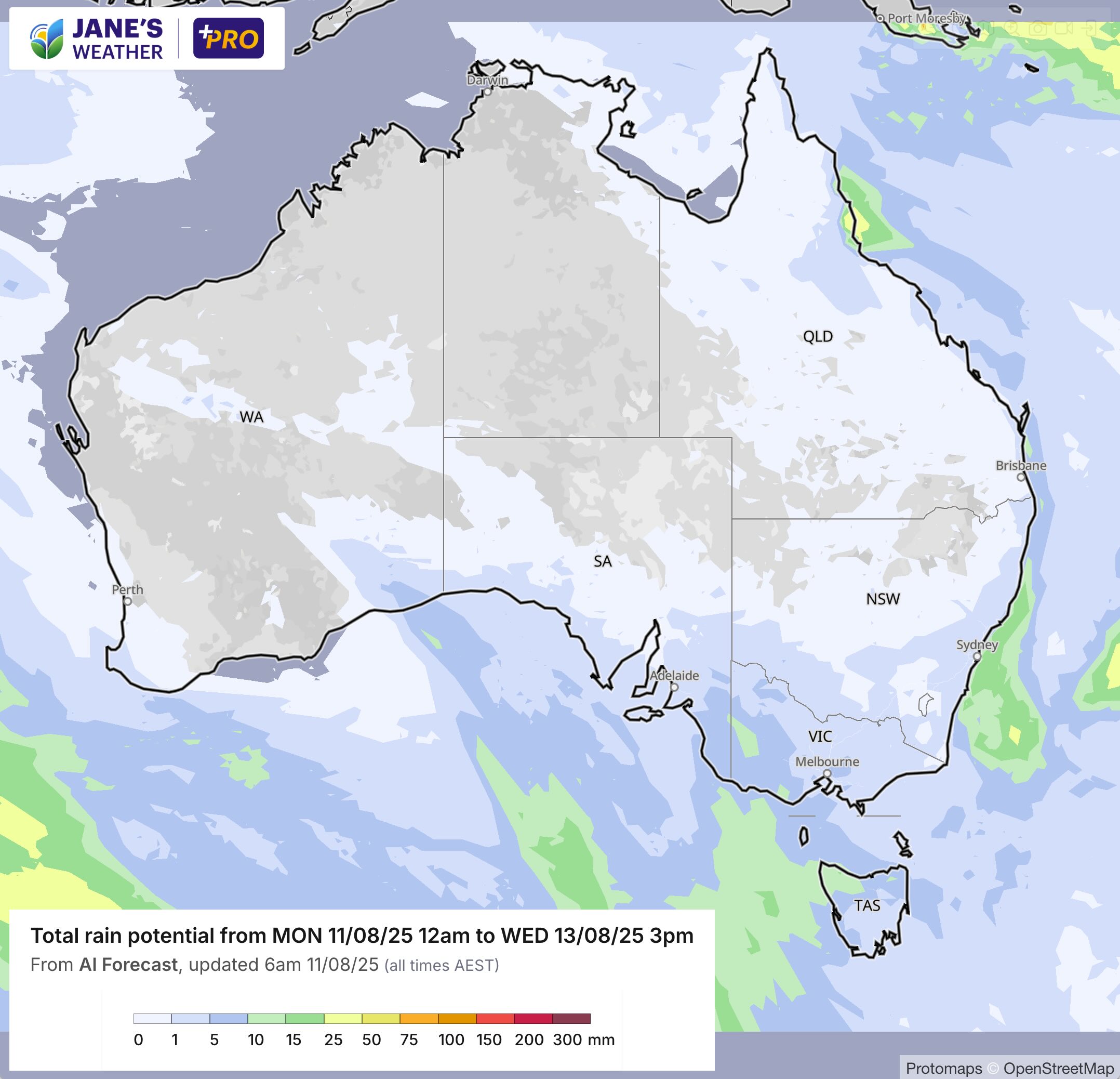
That front moves away on Wednesday.
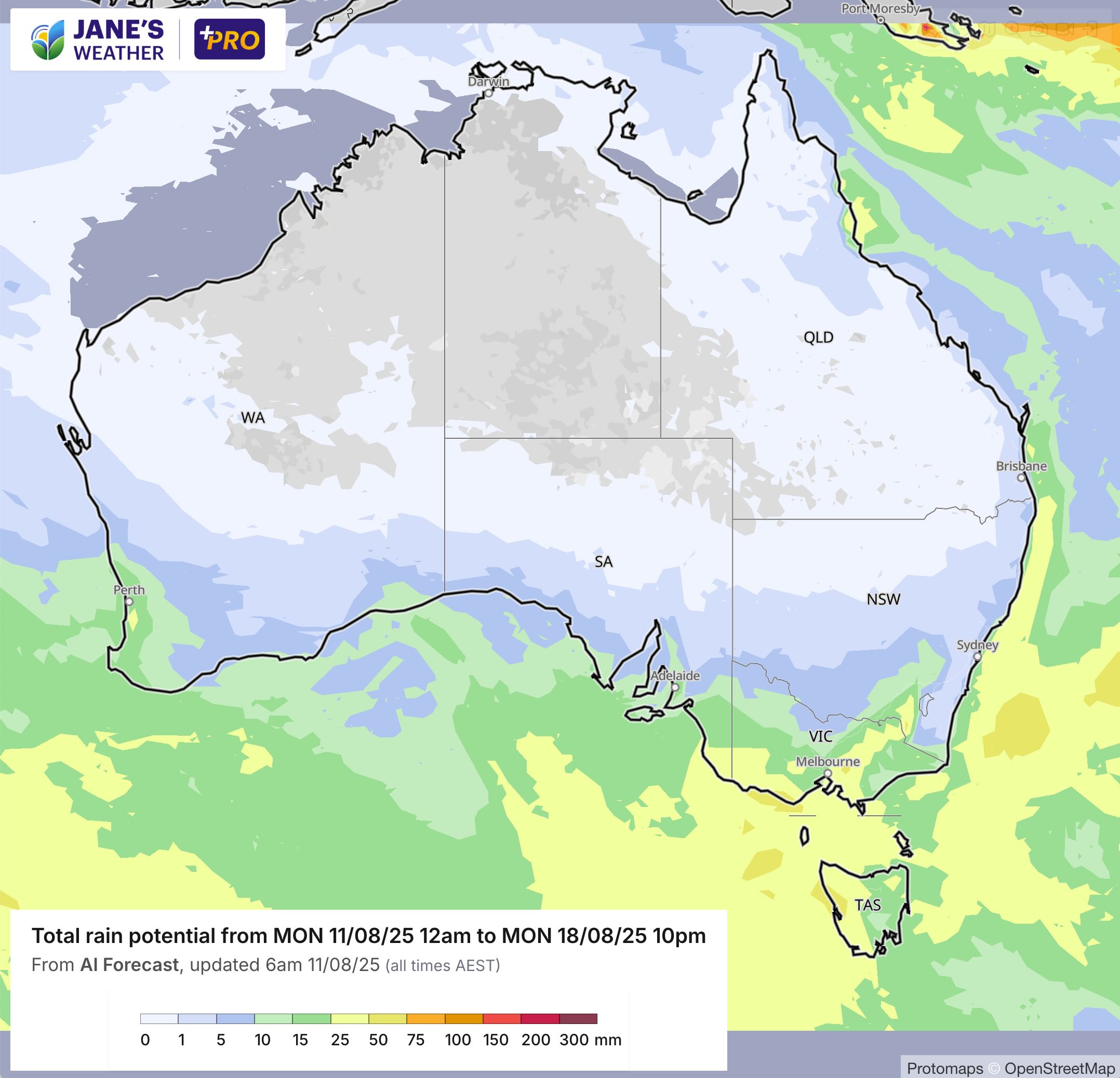
The next one is a bigger feature - and packs a cold air punch.
This front crosses the west on Thursday, with a different trajectory to the last one. The west sees 5 to 25 mm, as the front is still building as it passes by.
If affects SA, VIC, TAS and southern NSW on Friday/Saturday, generally with 5 to 20 mm.
It also introduces a pool of cold air, with the cold outbreak beginning late Friday night or early on Saturday.
Then we have part two.
A second front, peaking over the southeast, on Sunday into Monday, with another 5 to 20 mm.
We may have snow in unusual places, and the cold air extends right up into southern Queensland.

.png)
