
.png)

Southern Australia is in the firing line for big weather systems this week, while the north and east coast take a break.
The satellite late on Monday morning shows a very large area of speckled cloud over the west. This indicates just how bitter the air is.
Out ahead we have a band of rain that is just kicking off, fed by moisture from the Indian Ocean. This will slowly head eastwards early in the week.
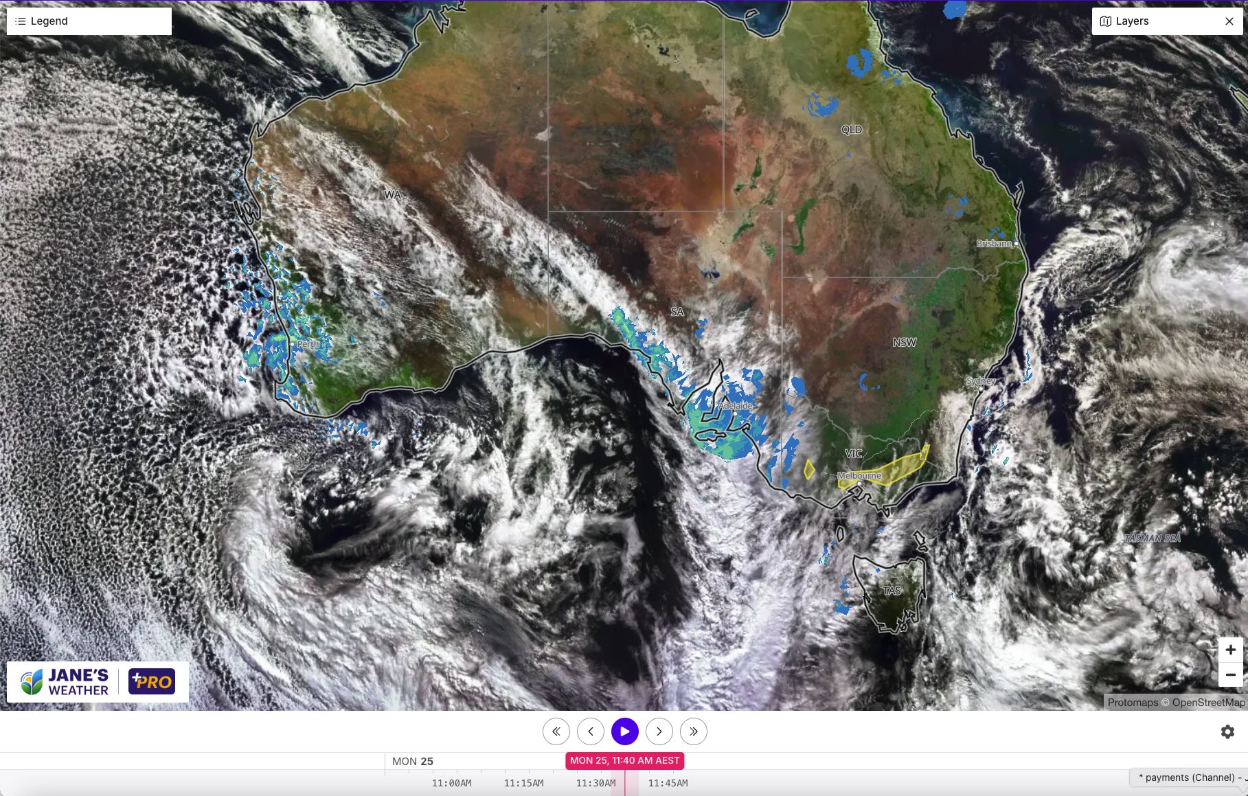
The rain continues in the west until mid-week, while it begins in the southeast on Tuesday - and lasts through the rest of the week and into the weekend.
High pressure has vanished. No longer acting like a burly bouncer at a club, the rain systems are free to stream through. And they don't end until the next bouncer's shift begins (which is mid-week in the west, and later in the weekend in the southeast).
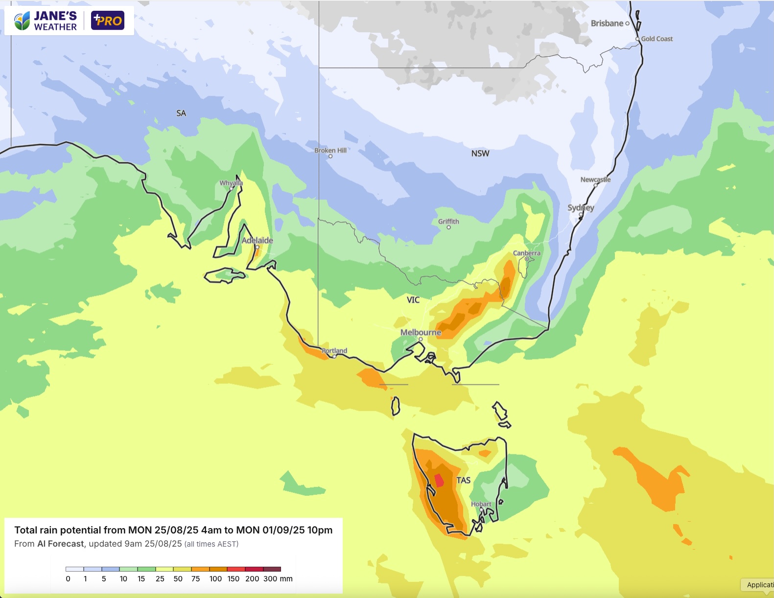
Such a long stretch of unimpeded weather systems is going to add up - especially in the southeast. Anywhere yellow is 25 to 50 mm of rain. Darker yellow and orange at the coast and ranges heads up to 100mm and beyond.
Even those inland, or north and west of the ranges see a decent drop from this.
Those east of the ranges do not. The east coast takes a break, on the dry side of the divide this time. There's no cloud, there's no rain, but there is a cold wind to offset the sunshine.
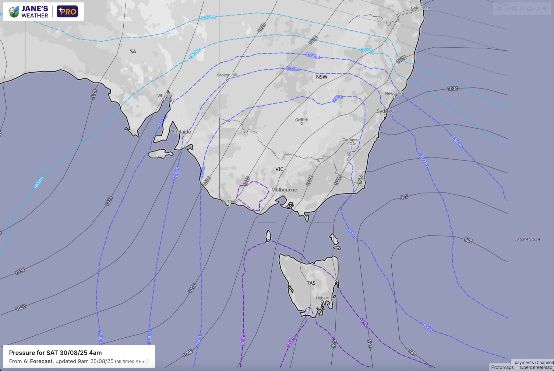
The coldest air waits until the end of the week to arrive in the southeast, after freezing the west on Monday. The pressure lines show that the air is coming straight up from the south to southwest, ie the shortest route between Antarctica and Australia, so it'll have bitter characteristics that are hardly softened on the short trip.
It should be cold enough for snow to fall to low levels. In Tasmania that may be as low as 200-300 metres. In Victoria that may be 500-600 metres. In NSW that is 700-800 metres on the southern Alps, and even 900 metres on the Blue Mountains west of Sydney - and around 1200 metres further north as we go through Saturday.
.png)
.png)
.png)