
.png)

In order to make it rain you need moisture and instability to work together, and we are seeing that occur in a big way at the end of the week and on the weekend.
The moisture part of the equation is the feed of tropical moisture from the Indian Ocean, streaming in across Australia from the northwest. This is evidence of the developing Negative Indian Ocean Dipole (IOD) that is set to encourage rain to be pushed towards Australia in late winter and spring. You can spot this on the satellite as a huge area of cloud coming in from the west.
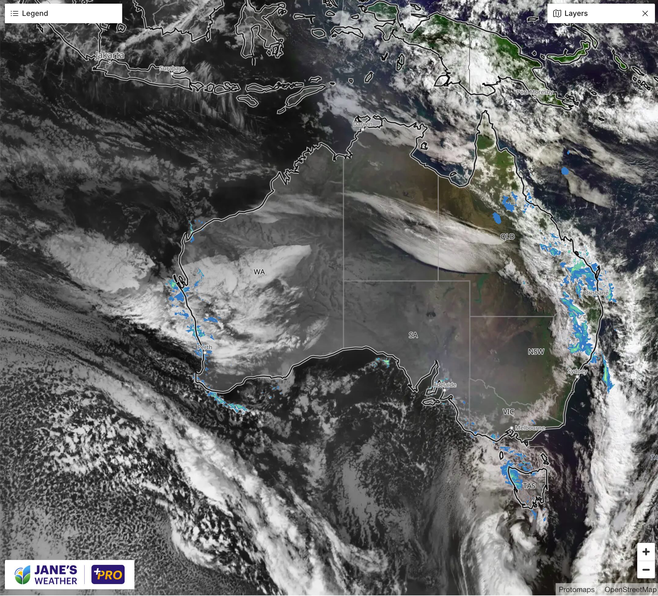
The instability part of the equation is driven by a low pressure system. The low forms over the Bight, as a cut off low. ‘Cut off’ because it is separated from the fast moving westerly winds to our south that would otherwise whisk it along. Instead it can take its time, soaking all those in its path.
This low is likely to be near Adelaide by late Friday, western Bass Strait (between Victoria and Tasmania) by late Saturday, and southern Tasmania by late Sunday. Those near the low will do very well in terms of rainfall totals.
A huge cold front is also connected and driven by this low, set to slowly move across the country from west to east. This feature has a great big rainband, and ensures that every state and territory sees rain from this event, not just those near the low.
.gif)
Some will miss out. While the low is strong, and takes a good path over the southeast, and the front is huge, taking a path across much of the country, the rain can’t reach every nook and cranny. The Great Dividing Range will play a big part in the areas that miss out, as the rain dries up as it crosses this vast mountain range. In this case it's from central Gippsland in Victoria, around the corner near Mallacoota, and up the east coast to about Coffs Harbour. This strip of land is on the dry side of the ranges in this type of weather pattern - but further north into southeast Queensland the rain gets through.
This is an Australia-wide rainfall event - ‘event’ because it affects such a huge area and takes several days to move through. And once this is through we aren’t finished, with another rain system lining up in the west on Sunday, set to move through next week.
.png)
.png)
