
.png)

Spring is the fight between hot and cold, as the tropics wake up after winter and heat builds in the north, while cold fronts with plenty of bite still try to come up from the south.
Where these meet in the middle we can end up with spectacular results.
As we go into the weekend we have the remains of a huge band of cloud that stretched from the Indian Ocean (with moisture pouring in thanks to the Negative Indian Ocean Dipole) across Australia to New Zealand. Most of the rain petered out by the time it reached eastern Australia (except as it crossed Tasmania and southwest Victoria earlier in the week). This one is so slow moving we’re still seeing it at the end of the week.
We take the remains of that and add a new source of moisture from the northeast (fed by the warmer than average waters off the Queensland coast). A trough sets up over the eastern states and - boom - welcome to spring thunderstorms.
When you mix moisture and instability we get towering cumulus clouds, that if they are unstable enough grow into cumulonimbus - the storm cloud. If there is even more instability they turn from garden variety thunderstorms into severe beasts, that are no longer a bit of lightning, thunder and rain, but can produce damaging winds, large hail and flash flooding.
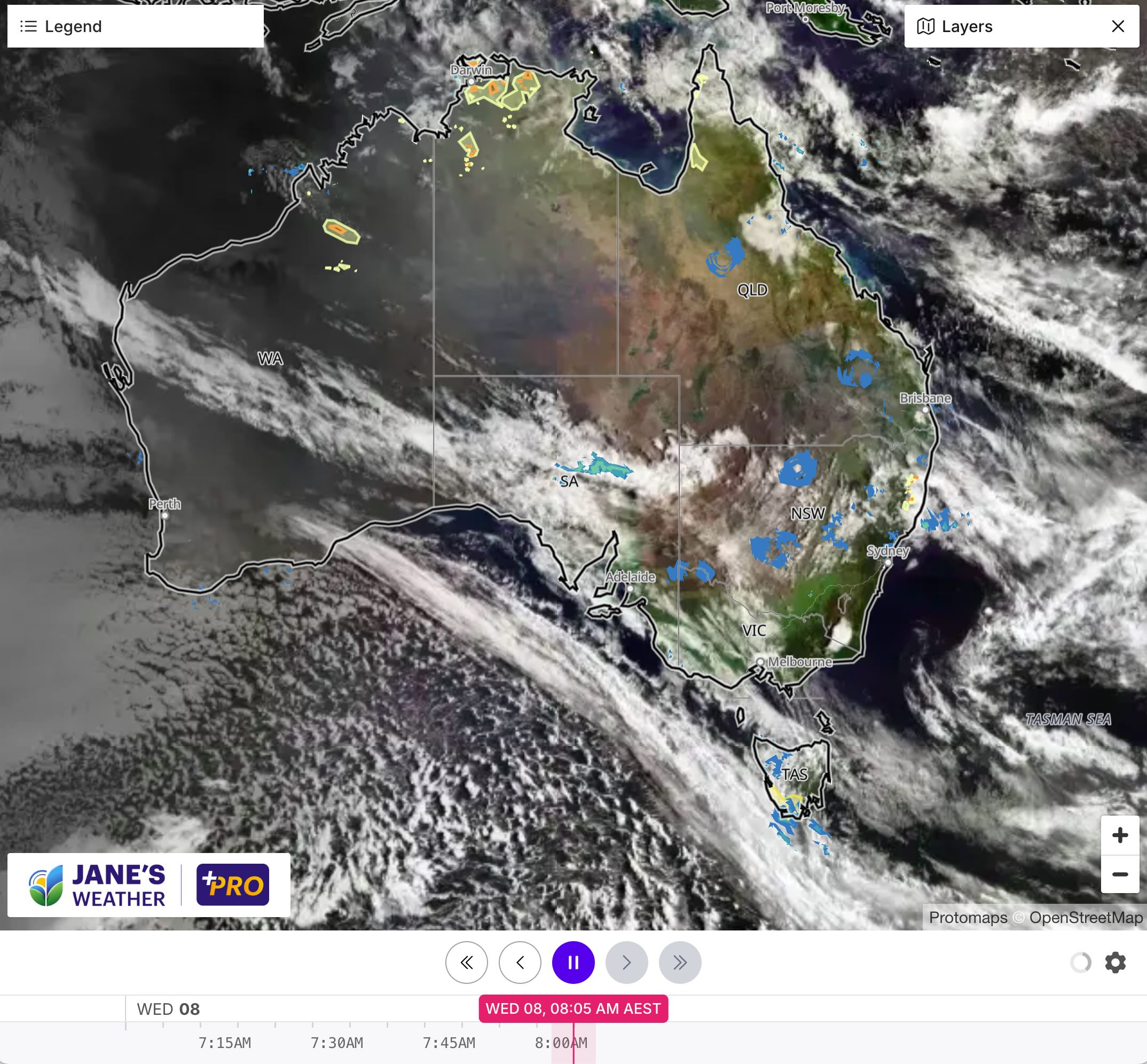
The location of the trough is an important element here. The moisture is on the trough and to its east, so that’s the area that has the risk of showers and storms. They are often hit and miss, start and stop. You certainly know about it if you are directly underneath one, and they can look spectacular from a vantage point all around as you bask in the sunshine.
If you are to the west of the trough (and there are no other weather features) then you are on the dry side. The dew point temperature tells us how much moisture is in the air, and to the west of the trough we have considerably lower dew points, indicating no moisture and no storms.
This week’s trough sets up over central NSW and Queensland, producing hit and miss showers and storms to its east as we finish the week and go into the weekend.
Then the next big rain system develops further west.
Likely to spread down through the interior, then across Queensland and northern NSW, on the weekend into early next week. This still has hit and miss thunderstorms, but they are embedded in a large area of widespread rain too, ensuring everyone gets a soak.
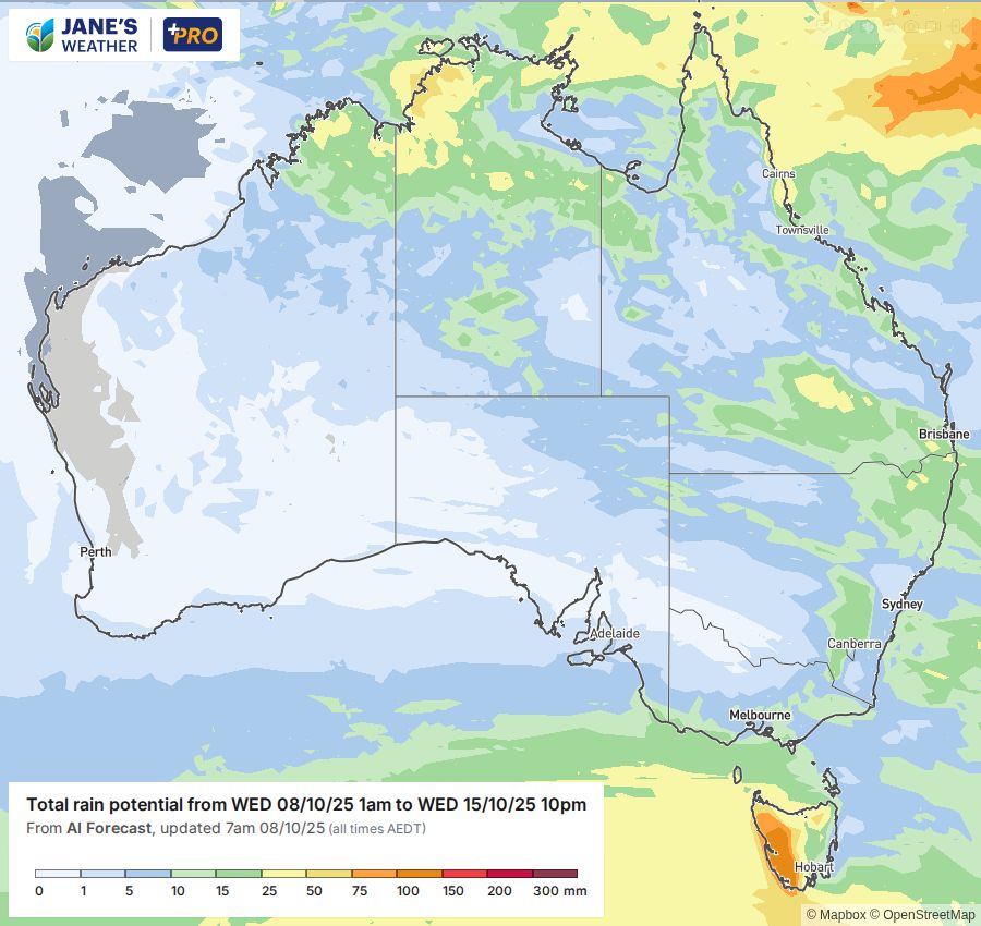
Meanwhile, the southeast has another cold outbreak shock - there may be snow to near sea level in southern Tasmania! And things look fairly quiet in the west, protected by a high.
.png)

