
.png)

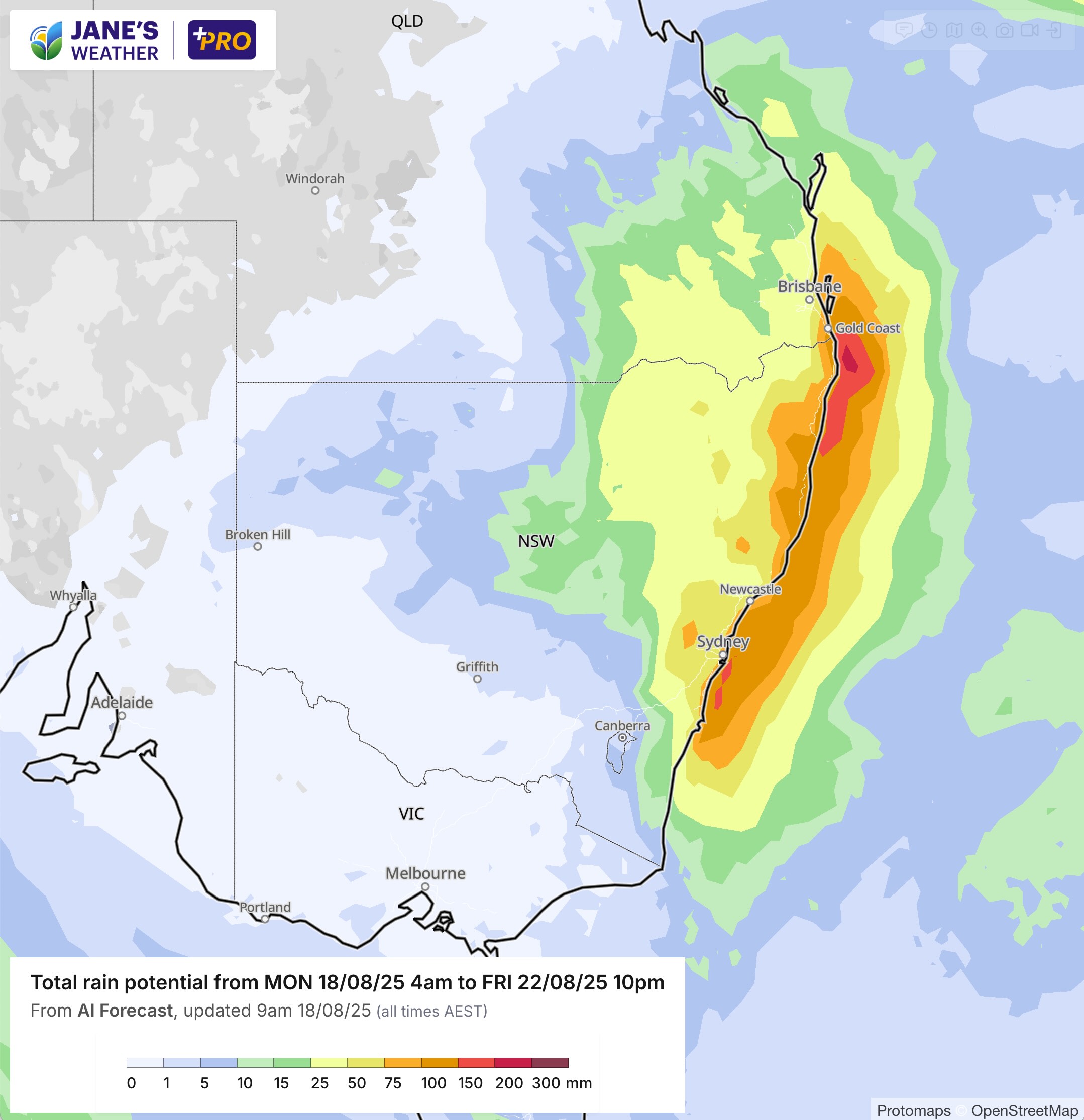
We have the perfect combination of moisture and instability this week, in a slow moving weather pattern that will ensure there is day after day of rain for much of eastern NSW and southeast QLD.
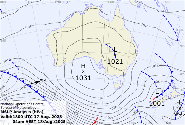
High pressure has formed a jelly bean shape over the Bight. A very weak low lies over western NSW. The jelly bean shape is important as it traps low pressure, not letting it dart away. While the surface low is very weak, it is supported by a strong upper atmosphere cold pool - think of it like the puppeteer and the puppet, the weather map doesn't show us what is happening upstairs out of sight.
This entire combination will very slowly move eastwards during the week - ensuring a steady supply of both instability and moisture converge over eastern NSW and southeast QLD.
There will be showers, tending to areas of widespread rain, and localised but powerful thunderstorms, day after day.
The highs slow path over SA, Victoria and Tasmania, then out to the Tasman Sea ensures that these areas remain generally dry - it couldn't be more different weather from those in the path of low pressure, and those dominated by the high. Frost and sunshine vs rain.
A weather system in the west is also producing widespread significant rain this week, but this isn't likely to reach the southeast either - just the remains of it this weekend which won't add up to much.
However, there may be something bigger for the southeast on the horizon, due early to mid next week (the 'week 2' weather system I highlighted in last Friday's weekly update).


.png)