
.png)

Over the course of the next week we have a few interesting things.
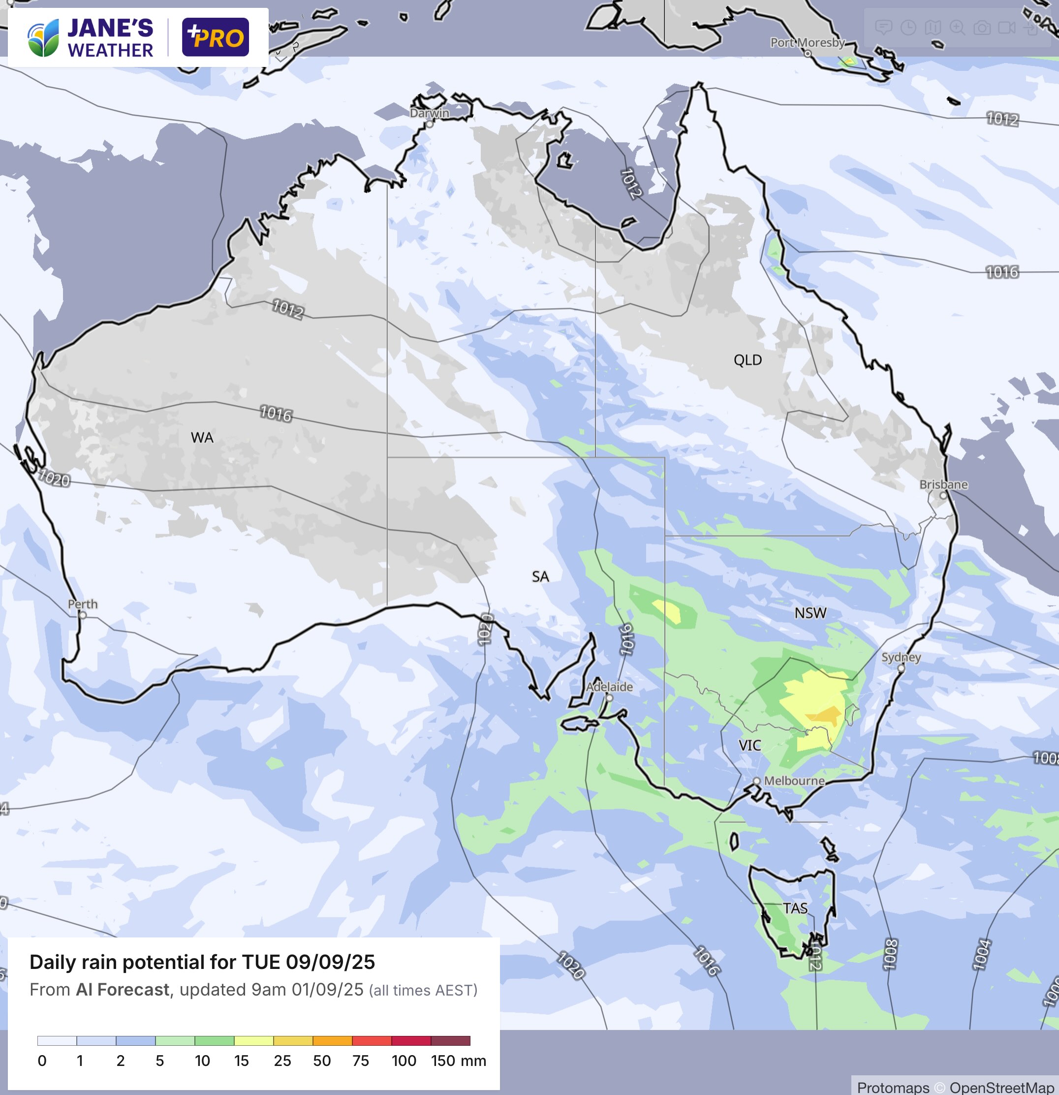
On Monday into Tuesday there is a weak disturbance over southeast QLD and northeast NSW. Showers, local storms, nothing significant but a hint that spring is here.
The next cold outbreak moves across the southeast mid to later in the week. This one is a bit different from the last one thanks to high pressure. It stops the cold air from extending well inland (no chill felt in QLD this time), and also stops the rain from extending far north. But if you're in Tasmania, or about the southeast coast, it'll have an impact.
Later in the week (Friday/Saturday) has us looking westwards at the next big system for the west. Significant rainfall from this one to kick off the weekend, easing as the weekend ends.
Then that could be the kicker for the next widespread rain system in the east.
.jpeg)
Back to the cold outbreak (yes it is the first week of spring, and no the weather pattern doesn't always like to follow the calendar :) ), this has a punch for Tasmania with low level snow, and southern VIC/southeast SA will really feel it too:

Here is a preview of the bigger weather system brewing for widespread rain early next week. As always it is a full week away, so there is low confidence, but it is one to watch:
.png)
.png)
.png)