
.png)

The complex low has now moved south of Tasmania and will continue to move away on Monday. The main cold front (that was huge, stretching right up into northern Queensland) has also moved well off the east coast. There are troughs to follow on Monday in the southeast, then this weather system is all over for Australia.
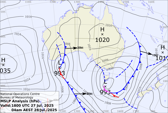
The next weather system is crossing the west. Another cut off low (so it can wander at leisure, affecting the mainland - rather than being whisked along by the fast westerlies to our south). This one doesn't have the huge feed of tropical moisture that the last one did. It also doesn't have the significantly deep/low pressure (when it moves across the east it should be around 1008hPa rather than in the 990s). In order to make it rain you need moisture and instability, and this system doesn't have as much of either of those ingredients.
It's still a lovely little follow up though.
.gif)
This low will take a path that brings the most rain to South Australia and NSW. But there are other aspects to consider too.
There are light falls in Victoria and Tasmania, but we also see a shake up once the system moves to the east late in the week.
A new feed of tropical moisture should spread across Queensland, while the instability deepens off the east coast. This combination means that a band of rain crosses Queensland and an area of rain affects eastern NSW and southeast Queensland. Eastern NSW missed out on the last one (on the dry side of the ranges) - but this one should bring significant falls.
Then we aren't done - you just need to look west early in the weekend to see the next weather system start to cross Western Australia.


